Erbiceni night lights from space
Night Light of Erbiceni (Iaşi) from space (Romania) Src. Average luminocity for 10x10km area is 0.0476% and for 50x50km: 1.6326%.
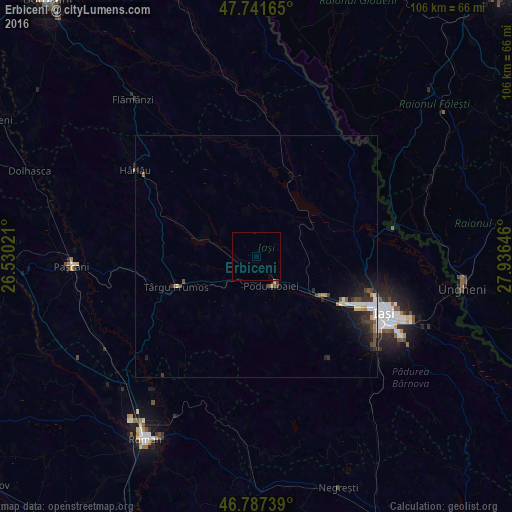
Analysis of Erbiceni night lights 2016
Square area 10x10 km:
 0%
0%90-99
0%80-89
0%70-79
0%60-69
0%50-59
0%40-49
0%30-39
0%20-29
0%10-19
0%0-9
100%Square area 50x50 km:
0.29%90-99
0.25%80-89
0.07%70-79
0.19%60-69
0.12%50-59
0.16%40-49
0.34%30-39
0.34%20-29
0.48%10-19
1.31%0-9
96.44%Clear (daylight) street map image can be seen on geolist.org.
Map coordinates:
47° 44' 29.9" North, 26° 31' 48.8" East
47° 16' 0" North, 27° 13' 60" East
46° 47' 14.6" North, 27° 56' 11.3" East
Some cities around Erbiceni sort by population:
• Târgu Frumos
19.1 km =11.9 mi,  247°
247°
• Belceşti
11.9 km =7.4 mi,  288°
288°
• Podu Iloaiei
6.1 km =3.8 mi,  155°
155°
• Leţcani
16.7 km =10.4 mi,  123°
123°
• Rediu
20.9 km =13 mi,  105°
105°
• Focuri
9.4 km =5.8 mi,  352°
352°
• Lungani
11.2 km =7 mi,  214°
214°
• Bălţaţi
8.4 km =5.2 mi,  228°
228°
678552 (p: 5,655)
Sources (retrieved 2019-11-25):
» Earth at Night: Flat Maps 2012, 2016