Călineşti night lights from space
Night Light of Călineşti (Arges) from space (Romania) Src. Average luminocity for 10x10km area is 11.954% and for 50x50km: 6.2758%.
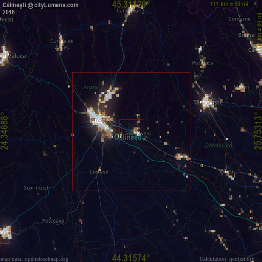
Analysis of Călineşti night lights 2016
Square area 10x10 km:
 1.27%
1.27%90-99
0.63%80-89
1.9%70-79
1.11%60-69
2.06%50-59
2.7%40-49
2.38%30-39
0.95%20-29
1.75%10-19
1.43%0-9
83.81%Square area 50x50 km:
0.92%90-99
1%80-89
0.34%70-79
0.62%60-69
0.84%50-59
0.95%40-49
1.07%30-39
0.97%20-29
2.25%10-19
4.44%0-9
86.61%Clear (daylight) street map image can be seen on geolist.org.
Map coordinates:
45° 18' 47.8" North, 24° 20' 48.8" East
44° 49' 0" North, 25° 3' 0" East
44° 18' 56.7" North, 25° 45' 11.3" East
Some cities around Călineşti sort by population:
• Piteşti
14.9 km =9.3 mi,  284°
284°
• Mioveni
18 km =11.2 mi,  331°
331°
• Ştefăneşti
9.6 km =6 mi,  304°
304°
• Topoloveni
2.6 km =1.6 mi,  90°
90°
• Başcov
20.6 km =12.8 mi, 296°
• Leordeni
6.4 km =4 mi,  125°
125°
• Bradu
12.4 km =7.7 mi,  252°
252°
• Ludeşti
15.5 km =9.6 mi,  68°
68°
682958 (p: 10,419)
Sources (retrieved 2019-11-25):
» Earth at Night: Flat Maps 2012, 2016