Bârla night lights from space
Night Light of Bârla (Arges) from space (Romania) Src. Average luminocity for 10x10km area is 0.3714% and for 50x50km: 0.1349%.
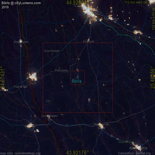
Analysis of Bârla night lights 2016
Square area 10x10 km:
 0%
0%90-99
0%80-89
0%70-79
0%60-69
0%50-59
0%40-49
0.32%30-39
0%20-29
0.63%10-19
0%0-9
99.05%Square area 50x50 km:
0%90-99
0%80-89
0%70-79
0%60-69
0%50-59
0.03%40-49
0.04%30-39
0.08%20-29
0.17%10-19
0.09%0-9
99.58%Clear (daylight) street map image can be seen on geolist.org.
Map coordinates:
44° 55' 33.7" North, 24° 4' 27.5" East
44° 25' 33.8" North, 24° 46' 38.7" East
43° 55' 18.3" North, 25° 28' 50" East
Some cities around Bârla sort by population:
• Slatina
32.6 km =20.3 mi,  271°
271°
• Roșiorii de Vede
38.1 km =23.7 mi,  154°
154°
• Scorniceşti
23.9 km =14.9 mi,  310°
310°
• Drăgăneşti-Olt
34.8 km =21.6 mi,  213°
213°
• Costeşti
28 km =17.4 mi,  17°
17°
• Buzoeşti
20.7 km =12.9 mi,  32°
32°
• Potcoava
12 km =7.5 mi,  302°
302°
• Dobroteşti
18 km =11.2 mi, 152°
684805 (p: 5,795)
Sources (retrieved 2019-11-25):
» Earth at Night: Flat Maps 2012, 2016