Afumaţi night lights from space
Night Light of Afumaţi (Ilfov) from space (Romania) Src. Average luminocity for 10x10km area is 26.3159% and for 50x50km: 23.6092%.
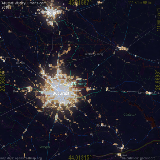
Analysis of Afumaţi night lights 2016
Square area 10x10 km:
100  1.11%
1.11%
90-99 3.49%
80-89 3.81%
70-79 2.38%
60-69 3.49%
50-59 3.02%
40-49 5.56%
30-39 6.98%
20-29 13.33%
10-19 23.81%
0-9 33.02%
1.11%90-99
3.49%80-89
3.81%70-79
2.38%60-69
3.49%50-59
3.02%40-49
5.56%30-39
6.98%20-29
13.33%10-19
23.81%0-9
33.02%Square area 50x50 km:
100 6.22%
90-99 5.28%
80-89 2.24%
70-79 2.42%
60-69 3.07%
50-59 2.55%
40-49 3.1%
30-39 2.73%
20-29 5.06%
10-19 7.07%
0-9 60.26%
6.22%90-99
5.28%80-89
2.24%70-79
2.42%60-69
3.07%50-59
2.55%40-49
3.1%30-39
2.73%20-29
5.06%10-19
7.07%0-9
60.26%Clear (daylight) street map image can be seen on geolist.org.
Map coordinates:
45° 0' 57.1" North, 25° 33' 48.8" East
44° 31' 0" North, 26° 16' 0" East
44° 0' 47.3" North, 26° 58' 11.3" East
Some cities around Afumaţi sort by population:
• Sector 3
13 km =8.1 mi,  216°
216°
• Sector 2
12.7 km =7.9 mi,  236°
236°
• Voluntari
8 km =5 mi,  248°
248°
• Pantelimon
9.1 km =5.7 mi, 215°
• Cernica
11.2 km =7 mi,  173°
173°
• Brăneşti
9.1 km =5.7 mi,  144°
144°
• Glina
14.9 km =9.3 mi,  185°
185°
• Dobroeşti
9.9 km =6.2 mi, 221°
686648 (p: 6,696)
Sources (retrieved 2019-11-25):
» Earth at Night: Flat Maps 2012, 2016