Trofa night lights from space
Night Light of Trofa (Porto) from space (Portugal) Src. Average luminocity for 10x10km area is 72.3129% and for 50x50km: 60.1975%.
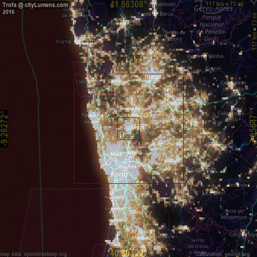
Analysis of Trofa night lights 2016
Square area 10x10 km:
 12.07%
90-99
19.73%80-89
7.82%70-79
10.37%60-69
19.22%50-59
14.46%40-49
9.01%30-39
7.31%20-29
0%10-19
0%0-9
0%Square area 50x50 km:
13.6%90-99
12.95%80-89
7.87%70-79
9.84%60-69
12.08%50-59
9%40-49
7.94%30-39
6.35%20-29
4.74%10-19
3.16%0-9
12.46%Clear (daylight) street map image can be seen on geolist.org.
Map coordinates:
41° 51' 47.1" North, 9° 15' 45.8" West
41° 20' 14.2" North, 8° 33' 34.6" West
40° 48' 26" North, 7° 51' 23.3" West
Some cities around Trofa sort by population:
• Bougado
0.7 km =0.4 mi,  66°
66°
• Santo Tirso
6.9 km =4.3 mi,  85°
85°
• Calendário
7.8 km =4.8 mi,  18°
18°
• Vila Nova de Famalicão
8.5 km =5.3 mi, 22°
• Ribeirão
2.7 km =1.7 mi,  345°
345°
• São Romão do Coronado
5.8 km =3.6 mi,  182°
182°
• Ferreiros
1.6 km =1 mi,  29°
29°
• São Miguel do Couto
8.2 km =5.1 mi, 94°
2733352 (p: 20,692)
Sources (retrieved 2019-11-25):
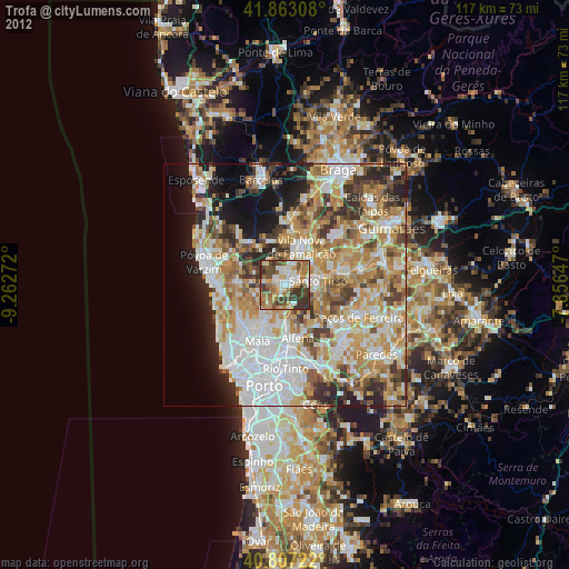
» Earth at Night: Flat Maps 2012, 2016