Lamego night lights from space
Night Light of Lamego (Viseu) from space (Portugal) Src. Average luminocity for 10x10km area is 15.5325% and for 50x50km: 10.1958%.
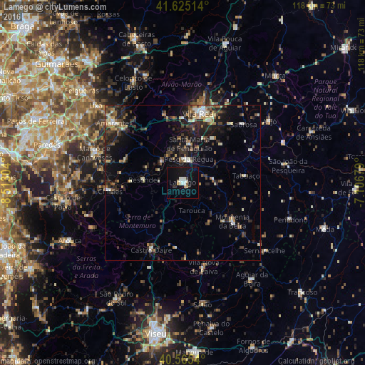
Analysis of Lamego night lights 2016
Square area 10x10 km:
 1.95%
1.95%90-99
3.9%80-89
1.3%70-79
1.95%60-69
0%50-59
0.65%40-49
0.65%30-39
0.65%20-29
1.3%10-19
22.4%0-9
65.26%Square area 50x50 km:
0.63%90-99
1.43%80-89
1.18%70-79
0.78%60-69
1.34%50-59
1.59%40-49
1.63%30-39
2.21%20-29
3.94%10-19
7.4%0-9
77.87%Clear (daylight) street map image can be seen on geolist.org.
Map coordinates:
41° 37' 30.5" North, 8° 30' 46.9" West
41° 5' 50.7" North, 7° 48' 35.7" West
40° 33' 55.4" North, 7° 6' 24.4" West
Some cities around Lamego sort by population:
• Baião
20.2 km =12.6 mi,  291°
291°
• Vila Real
23.3 km =14.5 mi,  13°
13°
• Moimenta da Beira
20.5 km =12.7 mi,  128°
128°
• Valadares
15.4 km =9.6 mi, 291°
• Sabrosa
27.2 km =16.9 mi,  46°
46°
• Tabuaço
20.4 km =12.7 mi,  84°
84°
• Vilela
22.4 km =13.9 mi, 50°
• Peso da Régua
7.5 km =4.7 mi, 13°
2738459 (p: 10,928)
Sources (retrieved 2019-11-25):
» Earth at Night: Flat Maps 2012, 2016