Cucujães night lights from space
Night Light of Cucujães (Aveiro) from space (Portugal) Src. Average luminocity for 10x10km area is 72.9524% and for 50x50km: 33.7042%.
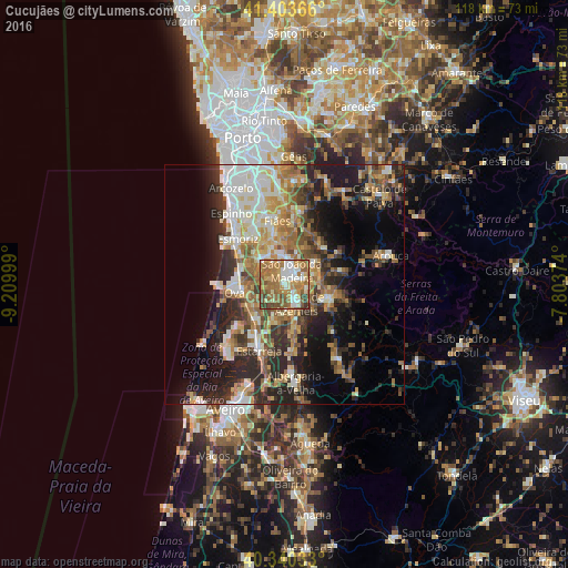
Analysis of Cucujães night lights 2016
Square area 10x10 km:
 10.54%
90-99
15.65%80-89
8.84%70-79
13.1%60-69
30.78%50-59
11.56%40-49
5.61%30-39
3.91%20-29
0%10-19
0%0-9
0%Square area 50x50 km:
4.55%90-99
6.25%80-89
4.28%70-79
5.17%60-69
6.37%50-59
5.12%40-49
4.05%30-39
5.32%20-29
9.97%10-19
12.39%0-9
36.52%Clear (daylight) street map image can be seen on geolist.org.
Map coordinates:
41° 24' 13.2" North, 9° 12' 36" West
40° 52' 26.9" North, 8° 30' 24.7" West
40° 20' 25.2" North, 7° 48' 13.5" West
Some cities around Cucujães sort by population:
• São João da Madeira
3.3 km =2.1 mi,  25°
25°
• Feira
6.4 km =4 mi,  332°
332°
• Oliveira de Azemeis
4.5 km =2.8 mi,  144°
144°
• Válega
7.5 km =4.7 mi,  235°
235°
• Arrifana
4.7 km =2.9 mi,  10°
10°
• São João
8.4 km =5.2 mi,  265°
265°
• Avanca
9.2 km =5.7 mi,  216°
216°
• São Roque
3 km =1.9 mi,  94°
94°
2740221 (p: 11,087)
Sources (retrieved 2019-11-25):
» Earth at Night: Flat Maps 2012, 2016