Branca night lights from space
Night Light of Branca (Aveiro) from space (Portugal) Src. Average luminocity for 10x10km area is 37.8539% and for 50x50km: 31.3048%.
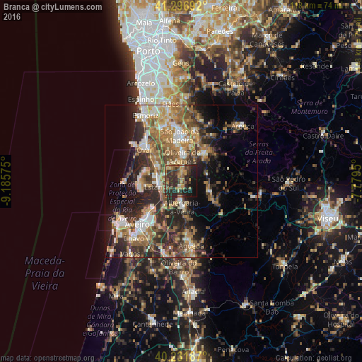
Analysis of Branca night lights 2016
Square area 10x10 km:
 0%
0%90-99
1.79%80-89
5.68%70-79
7.79%60-69
6.17%50-59
5.36%40-49
7.31%30-39
17.05%20-29
25.16%10-19
23.05%0-9
0.65%Square area 50x50 km:
2.84%90-99
5.41%80-89
3.75%70-79
4.65%60-69
6.74%50-59
5.82%40-49
4.18%30-39
6.28%20-29
11.05%10-19
10.41%0-9
38.87%Clear (daylight) street map image can be seen on geolist.org.
Map coordinates:
41° 17' 48.9" North, 9° 11' 8.7" West
40° 45' 59.5" North, 8° 28' 57.4" West
40° 13' 54.7" North, 7° 46' 46.2" West
Some cities around Branca sort by population:
• Oliveira de Azemeis
8.3 km =5.2 mi,  4°
4°
• Cucujães
12.1 km =7.5 mi,  350°
350°
• Beduido
6.6 km =4.1 mi,  267°
267°
• Albergaria-a-Velha
8.2 km =5.1 mi,  178°
178°
• Vale de Cambra
11.9 km =7.4 mi,  38°
38°
• Válega
11.3 km =7 mi,  313°
313°
• Avanca
8.8 km =5.5 mi,  301°
301°
• São Roque
11.8 km =7.3 mi, 4°
2742024 (p: 5,632)
Sources (retrieved 2019-11-25):
» Earth at Night: Flat Maps 2012, 2016