Anta night lights from space
Night Light of Anta (Porto) from space (Portugal) Src. Average luminocity for 10x10km area is 89.625% and for 50x50km: 50.361%.
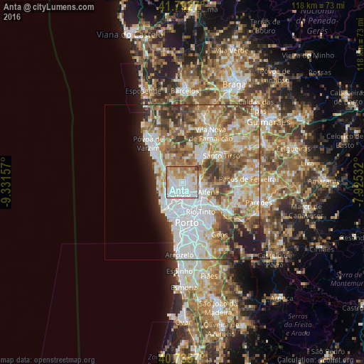
Analysis of Anta night lights 2016
Square area 10x10 km:
 42.86%
90-99
21.59%80-89
7.95%70-79
17.37%60-69
8.44%50-59
1.14%40-49
0.65%30-39
0%20-29
0%10-19
0%0-9
0%Square area 50x50 km:
13.81%90-99
11.27%80-89
6.02%70-79
7.54%60-69
8.92%50-59
6.08%40-49
5.52%30-39
4.71%20-29
4.31%10-19
4.51%0-9
27.31%Clear (daylight) street map image can be seen on geolist.org.
Map coordinates:
41° 47' 33.7" North, 9° 19' 53.7" West
41° 15' 58.8" North, 8° 37' 42.4" West
40° 44' 8.5" North, 7° 55' 31.2" West
Some cities around Anta sort by population:
• Maia
3.5 km =2.2 mi,  168°
168°
• Águas Santas
7.6 km =4.7 mi,  144°
144°
• Leça do Bailio
6.1 km =3.8 mi,  184°
184°
• Moreira
2.6 km =1.6 mi,  217°
217°
• Lavra
7.6 km =4.7 mi,  264°
264°
• São Romão do Coronado
5.9 km =3.7 mi,  68°
68°
• Santa Cruz do Bispo
6.9 km =4.3 mi,  213°
213°
• Gemunde
1.4 km =0.9 mi,  275°
275°
2742868 (p: 10,951)
Sources (retrieved 2019-11-25):
» Earth at Night: Flat Maps 2012, 2016