Lavra night lights from space
Night Light of Lavra (Porto) from space (Portugal) Src. Average luminocity for 10x10km area is 61.0617% and for 50x50km: 40.7285%.
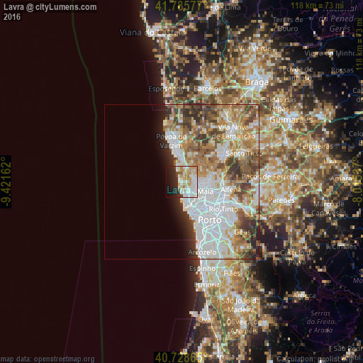
Analysis of Lavra night lights 2016
Square area 10x10 km:
 18.02%
90-99
18.02%80-89
6.01%70-79
12.34%60-69
4.06%50-59
1.3%40-49
1.79%30-39
4.71%20-29
13.15%10-19
14.12%0-9
6.49%Square area 50x50 km:
12.94%90-99
8.96%80-89
4.13%70-79
5.12%60-69
6.71%50-59
4.77%40-49
4.47%30-39
4.15%20-29
3.64%10-19
3.03%0-9
42.07%Clear (daylight) street map image can be seen on geolist.org.
Map coordinates:
41° 47' 8.8" North, 9° 25' 17.8" West
41° 15' 33.7" North, 8° 43' 6.6" West
40° 43' 43.1" North, 8° 0' 55.3" West
Some cities around Lavra sort by population:
• Maia
8.7 km =5.4 mi,  107°
107°
• Leça da Palmeira
7.8 km =4.8 mi,  168°
168°
• Leça do Bailio
8.8 km =5.5 mi,  126°
126°
• Moreira
6 km =3.7 mi,  102°
102°
• Anta
7.6 km =4.7 mi,  84°
84°
• Guifões
8 km =5 mi,  148°
148°
• Santa Cruz do Bispo
6.2 km =3.9 mi,  143°
143°
• Gemunde
6.2 km =3.9 mi, 81°
2738360 (p: 9,633)
Sources (retrieved 2019-11-25):
» Earth at Night: Flat Maps 2012, 2016