Żołynia night lights from space
Night Light of Żołynia (Subcarpathia) from space (Poland) Src. Average luminocity for 10x10km area is 0.1163% and for 50x50km: 5.1359%.
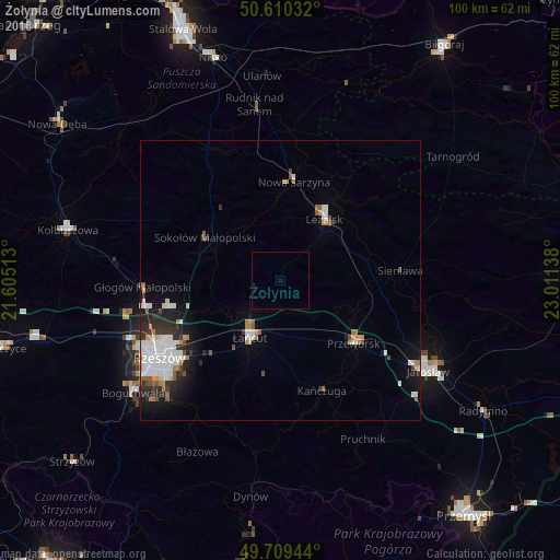
Analysis of Żołynia night lights 2016
Square area 10x10 km:
 0%
0%90-99
0%80-89
0%70-79
0%60-69
0%50-59
0%40-49
0%30-39
0%20-29
0%10-19
0%0-9
100%Square area 50x50 km:
1.18%90-99
1.3%80-89
0.26%70-79
0.46%60-69
0.53%50-59
0.45%40-49
0.39%30-39
0.53%20-29
1.4%10-19
2.29%0-9
91.2%Clear (daylight) street map image can be seen on geolist.org.
Map coordinates:
50° 36' 37.2" North, 21° 36' 18.5" East
50° 9' 43.2" North, 22° 18' 29.7" East
49° 42' 34" North, 23° 0' 41" East
Some cities around Żołynia sort by population:
• Rzeszów
25.8 km =16 mi,  238°
238°
• Łańcut
11.8 km =7.3 mi,  208°
208°
• Przeworsk
17.5 km =10.9 mi,  130°
130°
• Leżajsk
13.7 km =8.5 mi,  35°
35°
• Rakszawa
4.9 km =3 mi,  268°
268°
• Nowa Sarzyna
17.9 km =11.1 mi,  8°
8°
• Głogów Małopolski
24.6 km =15.3 mi, 267°
• Jeżowe
26.9 km =16.7 mi,  331°
331°
753130 (p: 5,145)
Sources (retrieved 2019-11-25):
» Earth at Night: Flat Maps 2012, 2016