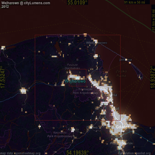
Wejherowo night lights from space
Night Light of Wejherowo (Pomerania) from space (Poland) Src. Average luminocity for 10x10km area is 29.8409% and for 50x50km: 11.4505%.
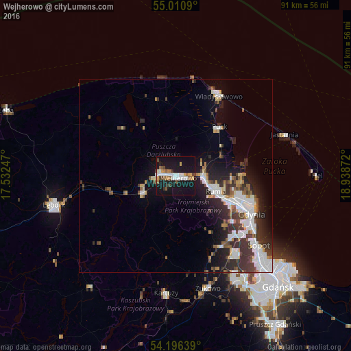
Analysis of Wejherowo night lights 2016
Square area 10x10 km:
 5.89%
5.89%90-99
5.76%80-89
1.25%70-79
3.01%60-69
3.88%50-59
4.14%40-49
2.76%30-39
2.13%20-29
1%10-19
50.38%0-9
19.8%Square area 50x50 km:
2.64%90-99
2.43%80-89
0.7%70-79
0.97%60-69
0.82%50-59
1.22%40-49
1.3%30-39
2.73%20-29
3.18%10-19
6.81%0-9
77.19%Clear (daylight) street map image can be seen on geolist.org.
Map coordinates:
55° 0' 39.2" North, 17° 31' 56.9" East
54° 36' 20.4" North, 18° 14' 8.1" East
54° 11' 47" North, 18° 56' 19.4" East
Some cities around Wejherowo sort by population:
• Gdynia
21.4 km =13.3 mi,  116°
116°
• Rumia
10.6 km =6.6 mi,  111°
111°
• Reda
7.2 km =4.5 mi,  90°
90°
• Puck
16.7 km =10.4 mi,  41°
41°
• Wielki Kack
22.4 km =13.9 mi,  133°
133°
• Bolszewo
4.1 km =2.5 mi,  289°
289°
• Luzino
9.3 km =5.8 mi,  241°
241°
• Gościcino
5.2 km =3.2 mi,  268°
268°
3082473 (p: 46,820)
Sources (retrieved 2019-11-25):
» Earth at Night: Flat Maps 2012, 2016