Gdynia night lights from space
Night Light of Gdynia (Pomerania) from space (Poland) Src. Average luminocity for 10x10km area is 60.6998% and for 50x50km: 18.2399%.
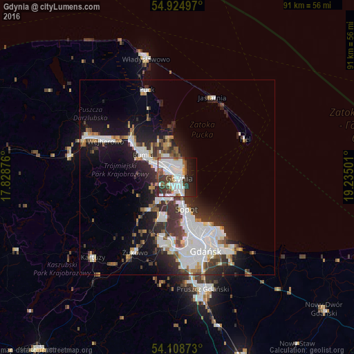
Analysis of Gdynia night lights 2016
Square area 10x10 km:
 20.93%
90-99
20.22%80-89
2.03%70-79
4.43%60-69
3.11%50-59
4.31%40-49
6.46%30-39
10.05%20-29
9.45%10-19
11.24%0-9
7.78%Square area 50x50 km:
5.23%90-99
4.29%80-89
1.01%70-79
1.28%60-69
1.39%50-59
1.51%40-49
1.92%30-39
3.49%20-29
4.87%10-19
9.05%0-9
65.95%Clear (daylight) street map image can be seen on geolist.org.
Map coordinates:
54° 55' 29.9" North, 17° 49' 43.5" East
54° 31' 8" North, 18° 31' 54.8" East
54° 6' 31.4" North, 19° 14' 6" East
Some cities around Gdynia sort by population:
• Gdańsk
20 km =12.4 mi,  158°
158°
• Wejherowo
21.4 km =13.3 mi,  296°
296°
• Rumia
10.9 km =6.8 mi, 301°
• Sopot
8.8 km =5.5 mi,  168°
168°
• Reda
15.3 km =9.5 mi,  308°
308°
• Puck
23.5 km =14.6 mi,  340°
340°
• Wielki Kack
6.4 km =4 mi,  206°
206°
• Żukowo
22.4 km =13.9 mi, 208°
3099424 (p: 253,730)
Sources (retrieved 2019-11-25):
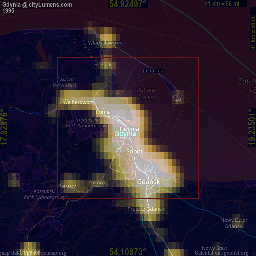
» NASA, Earths city lights 1995
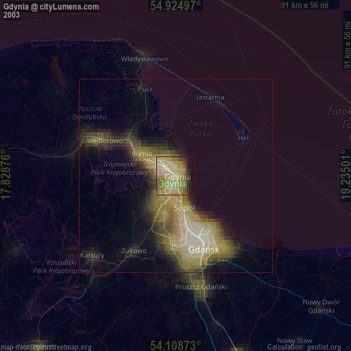
» NASA city lights 2003
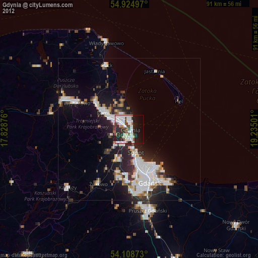
» Earth at Night: Flat Maps 2012, 2016