Tarnowskie Góry night lights from space
Night Light of Tarnowskie Góry (Silesia) from space (Poland) Src. Average luminocity for 10x10km area is 43.2689% and for 50x50km: 29.5984%.
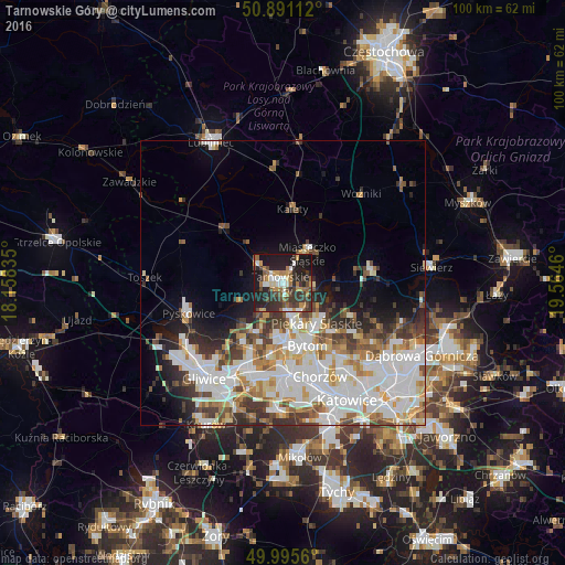


Analysis of Tarnowskie Góry night lights 2016
Square area 10x10 km:
 5.04%
5.04%90-99
6.02%80-89
1.82%70-79
7.42%60-69
8.96%50-59
5.18%40-49
9.8%30-39
11.34%20-29
20.03%10-19
23.95%0-9
0.42%Square area 50x50 km:
8.52%90-99
7.82%80-89
2.54%70-79
3.02%60-69
3.24%50-59
2.9%40-49
3.35%30-39
3.7%20-29
4.32%10-19
6.49%0-9
54.09%Clear (daylight) street map image can be seen on geolist.org.
Map coordinates:
50° 53' 28" North, 18° 9' 30.1" East
50° 26' 43.7" North, 18° 51' 41.3" East
49° 59' 44.2" North, 19° 33' 52.6" East
Some cities around Tarnowskie Góry sort by population:
• Zabrze
14.4 km =8.9 mi,  201°
201°
• Bytom
12 km =7.5 mi,  154°
154°
• Piekary Śląskie
8.6 km =5.3 mi, 147°
• Pyskowice
16.9 km =10.5 mi,  252°
252°
• Radzionków
5.8 km =3.6 mi, 150°
• Wojkowice
15.3 km =9.5 mi,  125°
125°
• Kalety
13.2 km =8.2 mi,  9°
9°
• Miasteczko Śląskie
8.4 km =5.2 mi,  40°
40°
3083440 (p: 60,938)
Sources (retrieved 2019-11-25):
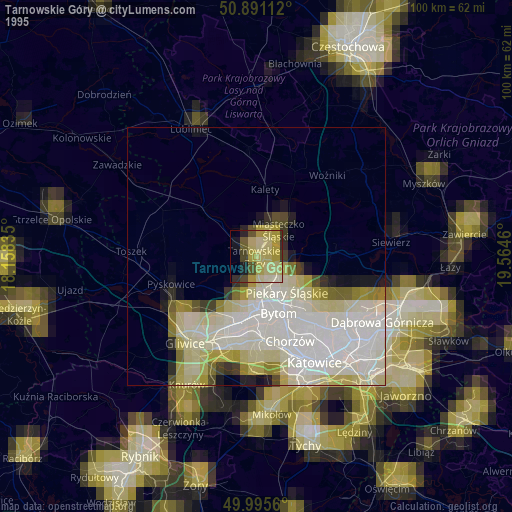
» NASA, Earths city lights 1995
» NASA city lights 2003
» Earth at Night: Flat Maps 2012, 2016