Rudnik nad Sanem night lights from space
Night Light of Rudnik nad Sanem (Subcarpathia) from space (Poland) Src. Average luminocity for 10x10km area is 0.6471% and for 50x50km: 2.1336%.
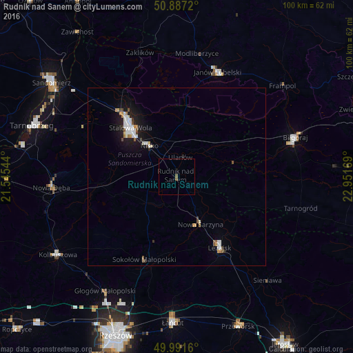
Analysis of Rudnik nad Sanem night lights 2016
Square area 10x10 km:
 0%
0%90-99
0%80-89
0%70-79
0%60-69
0%50-59
1.12%40-49
0%30-39
0%20-29
0%10-19
0%0-9
98.88%Square area 50x50 km:
0.42%90-99
0.46%80-89
0.13%70-79
0.18%60-69
0.21%50-59
0.25%40-49
0.15%30-39
0.15%20-29
0.2%10-19
2.01%0-9
95.82%Clear (daylight) street map image can be seen on geolist.org.
Map coordinates:
50° 53' 13.9" North, 21° 32' 43.6" East
50° 26' 29.5" North, 22° 14' 54.8" East
49° 59' 29.8" North, 22° 57' 6.1" East
Some cities around Rudnik nad Sanem sort by population:
• Stalowa Wola
20.9 km =13 mi,  318°
318°
• Nisko
11.6 km =7.2 mi, 318°
• Leżajsk
23.3 km =14.5 mi,  148°
148°
• Janów Lubelski
31.6 km =19.6 mi,  21°
21°
• Rakszawa
31.3 km =19.4 mi,  181°
181°
• Nowa Sarzyna
15 km =9.3 mi, 153°
• Jeżowe
11.3 km =7 mi,  229°
229°
• Żołynia
31.4 km =19.5 mi,  172°
172°
760055 (p: 6,770)
Sources (retrieved 2019-11-25):
» Earth at Night: Flat Maps 2012, 2016