Lubaczów night lights from space
Night Light of Lubaczów (Subcarpathia) from space (Poland) Src. Average luminocity for 10x10km area is 4.2447% and for 50x50km: 0.5375%.
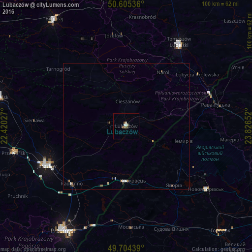
Analysis of Lubaczów night lights 2016
Square area 10x10 km:
 0.67%
0.67%90-99
0.94%80-89
0.53%70-79
0%60-69
0%50-59
1.74%40-49
0.94%30-39
0%20-29
0%10-19
0.53%0-9
94.65%Square area 50x50 km:
0.08%90-99
0.1%80-89
0.07%70-79
0.04%60-69
0.06%50-59
0.14%40-49
0.14%30-39
0.02%20-29
0%10-19
0.09%0-9
99.27%Clear (daylight) street map image can be seen on geolist.org.
Map coordinates:
50° 36' 19.3" North, 22° 25' 13" East
50° 9' 25.2" North, 23° 7' 24.2" East
49° 42' 15.8" North, 23° 49' 35.5" East
Some cities around Lubaczów sort by population:
• Jarosław
35.4 km =22 mi,  243°
243°
• Tomaszów Lubelski
38.4 km =23.9 mi,  32°
32°
• Yavoriv, UA
30.5 km =19 mi,  142°
142°
• Mostys'ka, UA
40.3 km =25 mi,  177°
177°
• Rava-Rus’ka, UA
36.9 km =22.9 mi,  77°
77°
• Radymno
31.7 km =19.7 mi,  222°
222°
• Oleszyce
6.4 km =4 mi,  280°
280°
• Shklo, UA
37.4 km =23.2 mi,  126°
126°
765932 (p: 12,595)
Sources (retrieved 2019-11-25):
» Earth at Night: Flat Maps 2012, 2016