Tando Adam night lights from space
Night Light of Tando Adam (Sindh) from space (Pakistan) Src. Average luminocity for 10x10km area is 28.1629% and for 50x50km: 5.0902%.
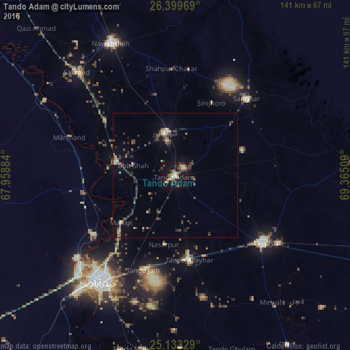
Analysis of Tando Adam night lights 2016
Square area 10x10 km:
 0.38%
0.38%90-99
3.79%80-89
4.55%70-79
1.52%60-69
6.63%50-59
4.55%40-49
9.09%30-39
4.55%20-29
5.11%10-19
29.55%0-9
30.3%Square area 50x50 km:
0.11%90-99
0.42%80-89
0.67%70-79
0.28%60-69
0.63%50-59
0.86%40-49
1.41%30-39
1.66%20-29
1.4%10-19
2.51%0-9
90.06%Clear (daylight) street map image can be seen on geolist.org.
Map coordinates:
26° 23' 58.9" North, 67° 57' 31.8" East
25° 46' 5.4" North, 68° 39' 43.1" East
25° 7' 59.8" North, 69° 21' 54.3" East
Some cities around Tando Adam sort by population:
• Shahdadpur
17.9 km =11.1 mi,  347°
347°
• Sanghar
42.3 km =26.3 mi,  42°
42°
• Hala
24.6 km =15.3 mi,  282°
282°
• Bhit Shah
17.6 km =10.9 mi, 283°
• Matiari
28.8 km =17.9 mi,  228°
228°
• Jhol
30.8 km =19.1 mi,  47°
47°
• Sinjhoro
32.6 km =20.3 mi,  26°
26°
• Berani
14.7 km =9.1 mi,  82°
82°
1163967 (p: 125,598)
Sources (retrieved 2019-11-25):
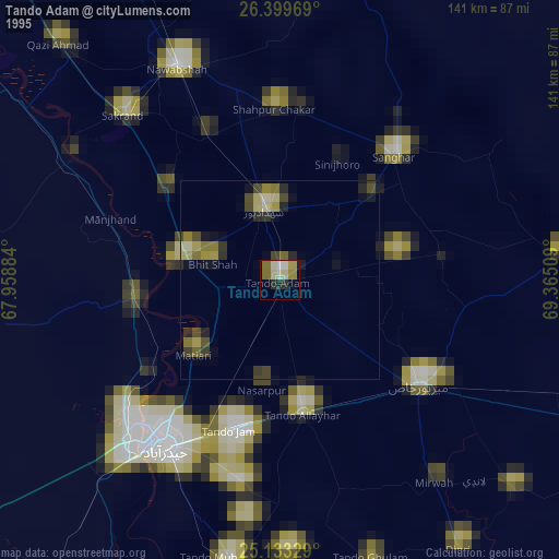
» NASA, Earths city lights 1995
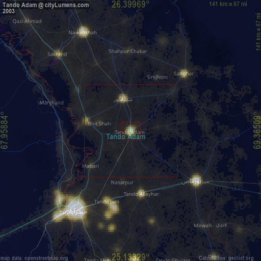
» NASA city lights 2003
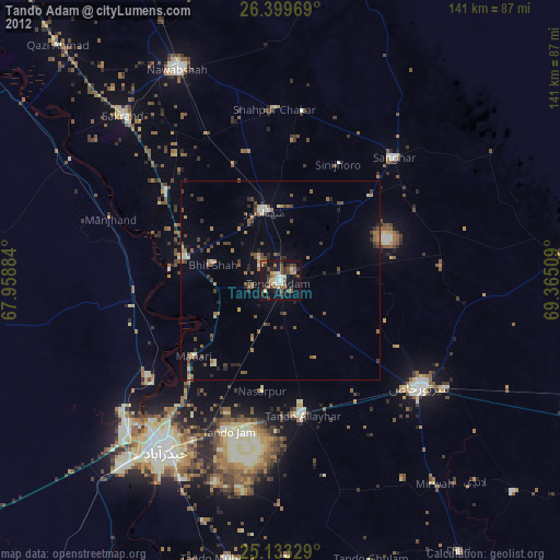
» Earth at Night: Flat Maps 2012, 2016