Miagao night lights from space
Night Light of Miagao (Western Visayas) from space (Philippines) Src. Average luminocity for 10x10km area is 0.9545% and for 50x50km: 0.2567%.
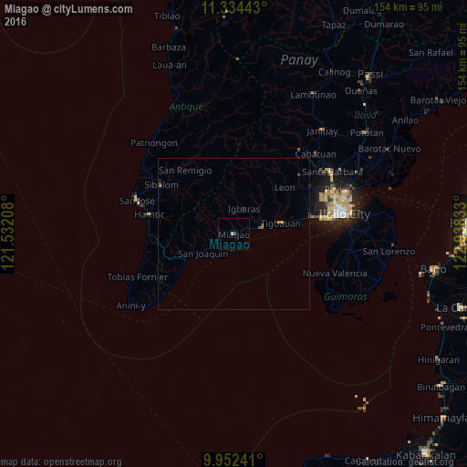
Analysis of Miagao night lights 2016
Square area 10x10 km:
 0%
0%90-99
0%80-89
0%70-79
0.83%60-69
0%50-59
0%40-49
0%30-39
0.83%20-29
0%10-19
0%0-9
98.35%Square area 50x50 km:
0%90-99
0%80-89
0%70-79
0.05%60-69
0.08%50-59
0.03%40-49
0.15%30-39
0.03%20-29
0.08%10-19
0.07%0-9
99.51%Clear (daylight) street map image can be seen on geolist.org.
Map coordinates:
11° 20' 3.9" North, 121° 31' 55.5" East
10° 38' 39.1" North, 122° 14' 6.7" East
9° 57' 8.7" North, 122° 56' 18" East
Some cities around Miagao sort by population:
• Oton
26.6 km =16.5 mi,  78°
78°
• Tigbauan
15.9 km =9.9 mi, 77°
• Trapiche
22 km =13.7 mi, 78°
• Alimodian
29.1 km =18.1 mi,  47°
47°
• Sibalom
28.8 km =17.9 mi,  304°
304°
• Guimbal
9.8 km =6.1 mi, 77°
• Buga
8.8 km =5.5 mi,  23°
23°
• Leon
22.7 km =14.1 mi, 47°
1699791 (p: 8,881)
Sources (retrieved 2019-11-25):
» Earth at Night: Flat Maps 2012, 2016