Guimbal night lights from space
Night Light of Guimbal (Western Visayas) from space (Philippines) Src. Average luminocity for 10x10km area is 1.314% and for 50x50km: 2.8295%.
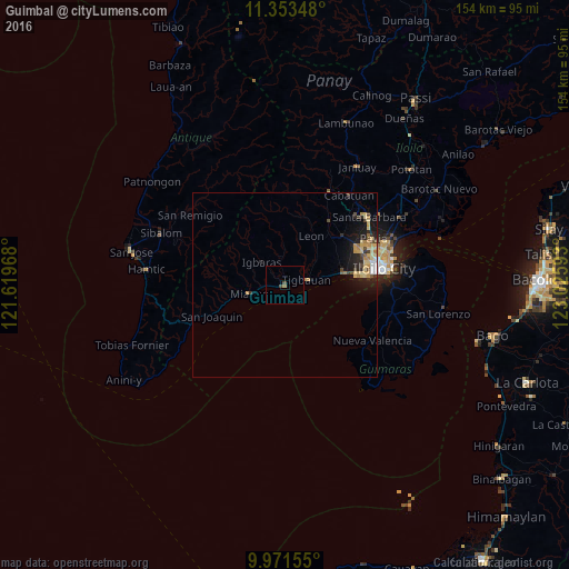
Analysis of Guimbal night lights 2016
Square area 10x10 km:
 0%
0%90-99
0%80-89
0%70-79
0%60-69
0.62%50-59
0.21%40-49
1.65%30-39
0%20-29
0%10-19
0%0-9
97.52%Square area 50x50 km:
0.13%90-99
0.19%80-89
0.84%70-79
0.59%60-69
0.4%50-59
0.18%40-49
0.47%30-39
0.34%20-29
0.77%10-19
2.19%0-9
93.92%Clear (daylight) street map image can be seen on geolist.org.
Map coordinates:
11° 21' 12.5" North, 121° 37' 10.8" East
10° 39' 47.9" North, 122° 19' 22.1" East
9° 58' 17.6" North, 123° 1' 33.3" East
Some cities around Guimbal sort by population:
• Oton
16.8 km =10.4 mi,  78°
78°
• Tigbauan
6.1 km =3.8 mi, 78°
• Trapiche
12.2 km =7.6 mi, 79°
• Miagao
9.8 km =6.1 mi,  257°
257°
• San Miguel
20.3 km =12.6 mi,  50°
50°
• Alimodian
21.2 km =13.2 mi,  33°
33°
• Buga
8.5 km =5.3 mi,  314°
314°
• Leon
15 km =9.3 mi, 29°
1712484 (p: 7,232)
Sources (retrieved 2019-11-25):
» Earth at Night: Flat Maps 2012, 2016