Lugait night lights from space
Night Light of Lugait (Northern Mindanao) from space (Philippines) Src. Average luminocity for 10x10km area is 5.3492% and for 50x50km: 2.163%.
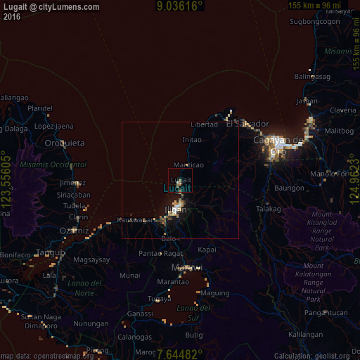
Analysis of Lugait night lights 2016
Square area 10x10 km:
 0.41%
0.41%90-99
0.41%80-89
0%70-79
0.62%60-69
2.07%50-59
2.27%40-49
0%30-39
0.21%20-29
0.62%10-19
0%0-9
93.39%Square area 50x50 km:
0.23%90-99
0.2%80-89
0.24%70-79
0.24%60-69
0.35%50-59
0.4%40-49
0.19%30-39
0.37%20-29
0.3%10-19
2.02%0-9
95.46%Clear (daylight) street map image can be seen on geolist.org.
Map coordinates:
9° 2' 10.2" North, 123° 33' 21.8" East
8° 20' 28" North, 124° 15' 33" East
7° 38' 41.4" North, 124° 57' 44.3" East
Some cities around Lugait sort by population:
• Iligan
12.6 km =7.8 mi,  187°
187°
• Iligan City
18.5 km =11.5 mi,  123°
123°
• Boroon
19.8 km =12.3 mi,  207°
207°
• Dalipuga
2.9 km =1.8 mi, 189°
• Initao
18.3 km =11.4 mi,  15°
15°
• Manticao
7.6 km =4.7 mi, 23°
• Rogongon
14.5 km =9 mi,  145°
145°
• Libertad
10.5 km =6.5 mi,  195°
195°
1705330 (p: 7,370)
Sources (retrieved 2019-11-25):
» Earth at Night: Flat Maps 2012, 2016