Ligao night lights from space
Night Light of Ligao (Bicol) from space (Philippines) Src. Average luminocity for 10x10km area is 6.0606% and for 50x50km: 2.0409%.
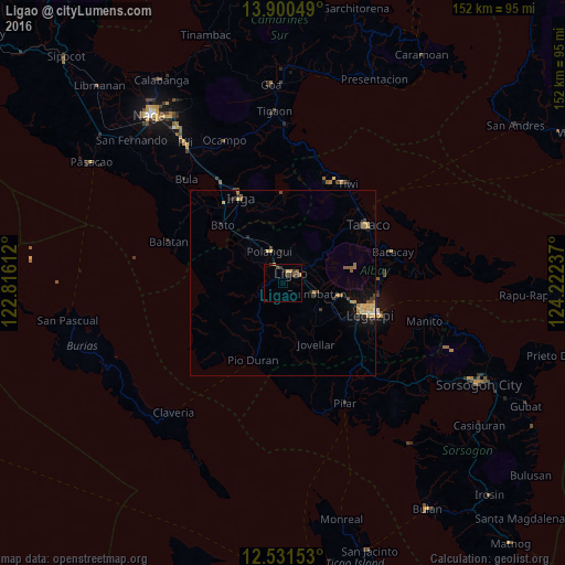
Analysis of Ligao night lights 2016
Square area 10x10 km:
 0%
0%90-99
0%80-89
1.95%70-79
0.65%60-69
0%50-59
2.16%40-49
1.73%30-39
2.16%20-29
2.16%10-19
0%0-9
89.18%Square area 50x50 km:
0.03%90-99
0.08%80-89
0.51%70-79
0.4%60-69
0.34%50-59
0.3%40-49
0.34%30-39
0.36%20-29
0.43%10-19
0.9%0-9
96.31%Clear (daylight) street map image can be seen on geolist.org.
Map coordinates:
13° 54' 1.8" North, 122° 48' 58" East
13° 13' 1.1" North, 123° 31' 9.3" East
12° 31' 53.5" North, 124° 13' 20.5" East
Some cities around Ligao sort by population:
• Polangui
9.1 km =5.7 mi,  336°
336°
• Libon
12.7 km =7.9 mi,  316°
316°
• San Jose
15.2 km =9.4 mi,  12°
12°
• Tagas
22.1 km =13.7 mi,  104°
104°
• Pantao
20.9 km =13 mi,  263°
263°
• Baligang
15.2 km =9.4 mi,  117°
117°
• Buluang
21.6 km =13.4 mi,  297°
297°
• Santa Justina
20.6 km =12.8 mi,  345°
345°
1706474 (p: 10,295)
Sources (retrieved 2019-11-25):
» Earth at Night: Flat Maps 2012, 2016