Kalibo (poblacion) night lights from space
Night Light of Kalibo (poblacion) (Western Visayas) from space (Philippines) Src. Average luminocity for 10x10km area is 10.7066% and for 50x50km: 0.5662%.
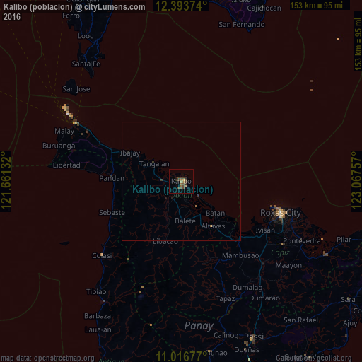
Analysis of Kalibo (poblacion) night lights 2016
Square area 10x10 km:
 0%
0%90-99
0%80-89
2.48%70-79
0%60-69
2.69%50-59
0.83%40-49
6.82%30-39
3.72%20-29
0.83%10-19
1.24%0-9
81.4%Square area 50x50 km:
0%90-99
0%80-89
0.1%70-79
0%60-69
0.16%50-59
0.05%40-49
0.28%30-39
0.25%20-29
0.1%10-19
0.1%0-9
98.96%Clear (daylight) street map image can be seen on geolist.org.
Map coordinates:
12° 23' 37.5" North, 121° 39' 40.8" East
11° 42' 22" North, 122° 21' 52" East
11° 1' 0.4" North, 123° 4' 3.3" East
Some cities around Kalibo (poblacion) sort by population:
• Roxas City
44.2 km =27.5 mi,  107°
107°
• Pandan
29.1 km =18.1 mi,  278°
278°
• Lanot
47.6 km =29.6 mi,  115°
115°
• Gibong
39.5 km =24.5 mi,  296°
296°
• Mambusao
39.6 km =24.6 mi,  139°
139°
• Bilao
32.3 km =20.1 mi, 138°
• New Washington
9.6 km =6 mi,  129°
129°
• Ivisan
41 km =25.5 mi, 119°
1709632 (p: 56,845)
Sources (retrieved 2019-11-25):
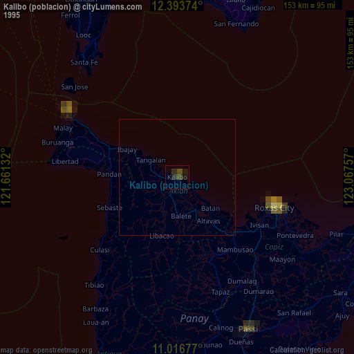
» NASA, Earths city lights 1995
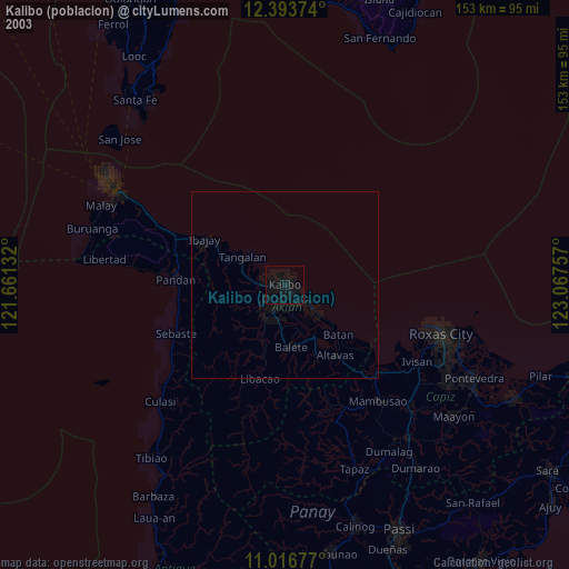
» NASA city lights 2003
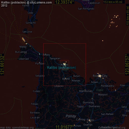
» Earth at Night: Flat Maps 2012, 2016