Asingan night lights from space
Night Light of Asingan (Ilocos) from space (Philippines) Src. Average luminocity for 10x10km area is 1.8636% and for 50x50km: 2.982%.
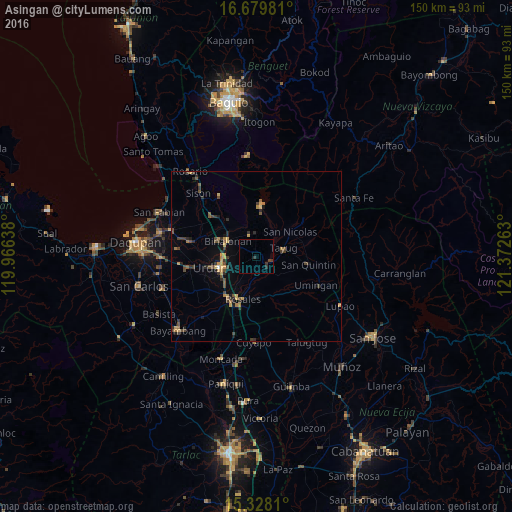
Analysis of Asingan night lights 2016
Square area 10x10 km:
 0%
0%90-99
0%80-89
0%70-79
0%60-69
0%50-59
0%40-49
0.41%30-39
2.07%20-29
1.24%10-19
0%0-9
96.28%Square area 50x50 km:
0.02%90-99
0.02%80-89
0.31%70-79
0.68%60-69
0.45%50-59
0.41%40-49
0.98%30-39
0.93%20-29
0.72%10-19
0.75%0-9
94.75%Clear (daylight) street map image can be seen on geolist.org.
Map coordinates:
16° 40' 47.3" North, 119° 57' 59" East
16° 0' 18.4" North, 120° 40' 10.2" East
15° 19' 41.2" North, 121° 22' 21.5" East
Some cities around Asingan sort by population:
• Urdaneta
11 km =6.8 mi,  252°
252°
• Guiset East
7 km =4.3 mi,  12°
12°
• Tayug
8.3 km =5.2 mi,  72°
72°
• Binalonan
9.6 km =6 mi,  301°
301°
• Carusucan
5.6 km =3.5 mi,  219°
219°
• Caramutan
11.3 km =7 mi,  214°
214°
• Macalong
1.5 km =0.9 mi,  309°
309°
• Domampot
2.2 km =1.4 mi, 254°
1730070 (p: 8,887)
Sources (retrieved 2019-11-25):
» Earth at Night: Flat Maps 2012, 2016