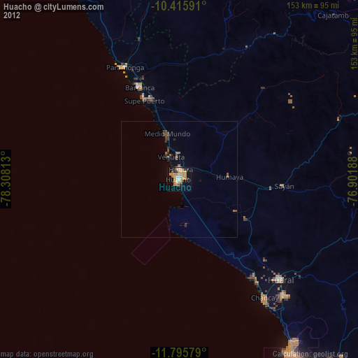
Huacho night lights from space
Night Light of Huacho (Lima region) from space (Peru) Src. Average luminocity for 10x10km area is 35.9264% and for 50x50km: 2.4432%.

Analysis of Huacho night lights 2016
Square area 10x10 km:
 4.11%
4.11%90-99
4.33%80-89
2.16%70-79
4.55%60-69
18.61%50-59
1.52%40-49
2.38%30-39
4.33%20-29
6.93%10-19
32.25%0-9
18.83%Square area 50x50 km:
0.16%90-99
0.17%80-89
0.12%70-79
0.2%60-69
1.08%50-59
0.2%40-49
0.42%30-39
0.29%20-29
0.56%10-19
2.01%0-9
94.78%Clear (daylight) street map image can be seen on geolist.org.
Map coordinates:
10° 24' 57.3" South, 78° 18' 29.3" West
11° 6' 24" South, 77° 36' 18" West
11° 47' 44.8" South, 76° 54' 6.8" West
Some cities around Huacho sort by population:
• Barranca
43.4 km =27 mi,  336°
336°
• Hualmay
1.5 km =0.9 mi,  319°
319°
• Huaura
4.1 km =2.5 mi,  8°
8°
• Supe
36.3 km =22.6 mi, 341°
• Puerto Supe
37.2 km =23.1 mi, 336°
• Végueta
10.3 km =6.4 mi, 335°
• Sayán
44.9 km =27.9 mi,  93°
93°
• Caleta de Carquín
2.8 km =1.7 mi,  303°
303°
3940002 (p: 54,545)
Sources (retrieved 2019-11-25):
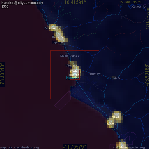
» NASA, Earths city lights 1995
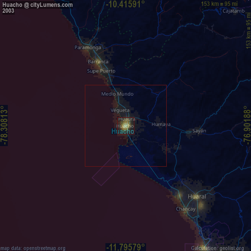
» NASA city lights 2003
» Earth at Night: Flat Maps 2012, 2016