El Porvenir night lights from space
Night Light of El Porvenir (Guna Yala) from space (Panama) Src. Average luminocity for 10x10km area is 0% and for 50x50km: 0%.
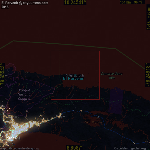
Analysis of El Porvenir night lights 2016
Square area 10x10 km:
 0%
0%90-99
0%80-89
0%70-79
0%60-69
0%50-59
0%40-49
0%30-39
0%20-29
0%10-19
0%0-9
100%Square area 50x50 km:
0%90-99
0%80-89
0%70-79
0%60-69
0%50-59
0%40-49
0%30-39
0%20-29
0%10-19
0%0-9
100%Clear (daylight) street map image can be seen on geolist.org.
Map coordinates:
10° 14' 43.5" North, 79° 39' 19.5" West
9° 33' 9.9" North, 78° 57' 8.3" West
8° 51' 31.3" North, 78° 14' 57" West
Some cities around El Porvenir sort by population:
• San Miguelito
79.7 km =49.5 mi,  225°
225°
• Juan Díaz
78.1 km =48.5 mi,  224°
224°
• Pedregal
75.5 km =46.9 mi, 224°
• Tocumen
69.9 km =43.4 mi, 222°
• Nuevo Belén
71.7 km =44.6 mi, 222°
• Chepo
45.6 km =28.3 mi,  200°
200°
• Nueva Esperanza
65.3 km =40.6 mi, 219°
• Pacora
64.4 km =40 mi, 215°
3710114 (p: 10)
Sources (retrieved 2019-11-25):
» Earth at Night: Flat Maps 2012, 2016