Tananger night lights from space
Night Light of Tananger (Rogaland) from space (Norway) Src. Average luminocity for 10x10km area is 35.895% and for 50x50km: 11.7257%.
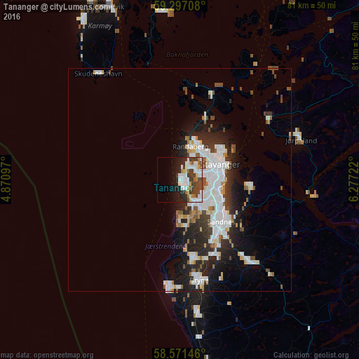
Analysis of Tananger night lights 2016
Square area 10x10 km:
 9.63%
9.63%90-99
9.74%80-89
2.06%70-79
2.16%60-69
3.03%50-59
2.38%40-49
6.82%30-39
7.9%20-29
7.9%10-19
12.23%0-9
36.15%Square area 50x50 km:
3.22%90-99
2.98%80-89
0.8%70-79
0.63%60-69
0.89%50-59
0.89%40-49
1.5%30-39
1.28%20-29
3.57%10-19
5.77%0-9
78.47%Clear (daylight) street map image can be seen on geolist.org.
Map coordinates:
59° 17' 49.5" North, 4° 52' 15.5" East
58° 56' 10.2" North, 5° 34' 26.8" East
58° 34' 17.3" North, 6° 16' 38" East
Some cities around Tananger sort by population:
• Stavanger
9.9 km =6.2 mi,  67°
67°
• Sandnes
13.1 km =8.1 mi,  135°
135°
• Bryne
22.7 km =14.1 mi,  169°
169°
• Sæveland
42.5 km =26.4 mi,  329°
329°
• Kopervik
41.5 km =25.8 mi,  338°
338°
• Hommersåk
15.9 km =9.9 mi,  94°
94°
• Jørpeland
28.4 km =17.6 mi, 70°
• Åkrehamn
42.3 km =26.3 mi, 328°
3134865 (p: 5,817)
Sources (retrieved 2019-11-25):
» Earth at Night: Flat Maps 2012, 2016