Sandnes night lights from space
Night Light of Sandnes (Rogaland) from space (Norway) Src. Average luminocity for 10x10km area is 59.7823% and for 50x50km: 12.2707%.
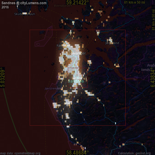
Analysis of Sandnes night lights 2016
Square area 10x10 km:
 22.22%
90-99
16.78%80-89
5.1%70-79
2.38%60-69
2.72%50-59
1.81%40-49
6.12%30-39
10.88%20-29
16.21%10-19
13.04%0-9
2.72%Square area 50x50 km:
3.3%90-99
3.07%80-89
0.9%70-79
0.68%60-69
0.96%50-59
0.96%40-49
1.29%30-39
1.29%20-29
3.61%10-19
6.85%0-9
77.1%Clear (daylight) street map image can be seen on geolist.org.
Map coordinates:
59° 12' 51.2" North, 5° 1' 55.5" East
58° 51' 8.8" North, 5° 44' 6.8" East
58° 29' 12.6" North, 6° 26' 18" East
Some cities around Sandnes sort by population:
• Stavanger
13.1 km =8.1 mi,  359°
359°
• Egersund
47.2 km =29.3 mi,  161°
161°
• Bryne
14 km =8.7 mi,  201°
201°
• Kopervik
53.8 km =33.4 mi,  332°
332°
• Tananger
13.1 km =8.1 mi,  315°
315°
• Hommersåk
10.5 km =6.5 mi,  39°
39°
• Jørpeland
25.8 km =16 mi, 42°
• Åkrehamn
55.2 km =34.3 mi, 325°
3140321 (p: 63,032)
Sources (retrieved 2019-11-25):
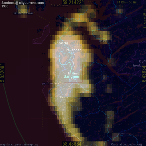
» NASA, Earths city lights 1995
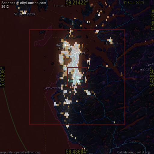
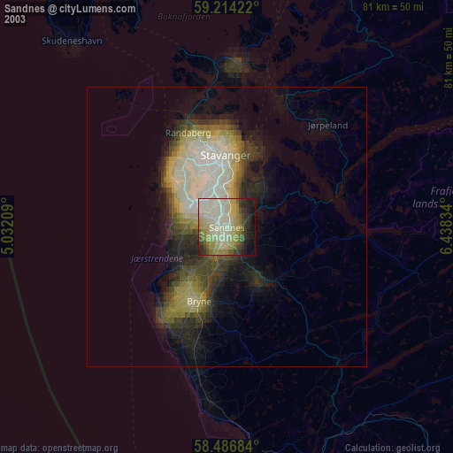
» NASA city lights 2003
» Earth at Night: Flat Maps 2012, 2016