Kristiansand night lights from space
Night Light of Kristiansand (Vest-Agder) from space (Norway) Src. Average luminocity for 10x10km area is 51.592% and for 50x50km: 6.252%.
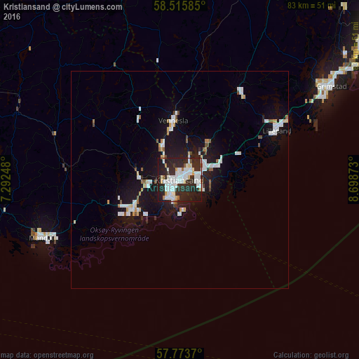
Analysis of Kristiansand night lights 2016
Square area 10x10 km:
 15.34%
90-99
17.5%80-89
2.73%70-79
2.27%60-69
1.7%50-59
1.48%40-49
1.02%30-39
4.2%20-29
36.59%10-19
16.82%0-9
0.34%Square area 50x50 km:
1.48%90-99
1.53%80-89
0.4%70-79
0.38%60-69
0.3%50-59
0.44%40-49
0.3%30-39
0.25%20-29
1.91%10-19
6.47%0-9
86.52%Clear (daylight) street map image can be seen on geolist.org.
Map coordinates:
58° 30' 57.1" North, 7° 17' 32.9" East
58° 8' 48.2" North, 7° 59' 44.2" East
57° 46' 25.3" North, 8° 41' 55.4" East
Some cities around Kristiansand sort by population:
• Arendal
57.3 km =35.6 mi,  52°
52°
• Vennesla
13.6 km =8.5 mi,  354°
354°
• Mandal
34.5 km =21.4 mi,  247°
247°
• Grimstad
41.1 km =25.5 mi,  58°
58°
• Søgne
13.8 km =8.6 mi,  244°
244°
• Lillesand
25.1 km =15.6 mi, 63°
• Flekkefjord
79.9 km =49.6 mi,  282°
282°
• Kragerø
115.1 km =71.5 mi, 45°
3149318 (p: 63,814)
Sources (retrieved 2019-11-25):
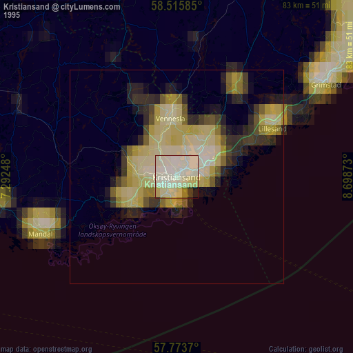
» NASA, Earths city lights 1995
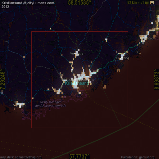
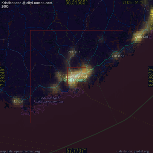
» NASA city lights 2003
» Earth at Night: Flat Maps 2012, 2016