Naarden night lights from space
Night Light of Naarden (North Holland) from space (Netherlands) Src. Average luminocity for 10x10km area is 41.1641% and for 50x50km: 32.6358%.
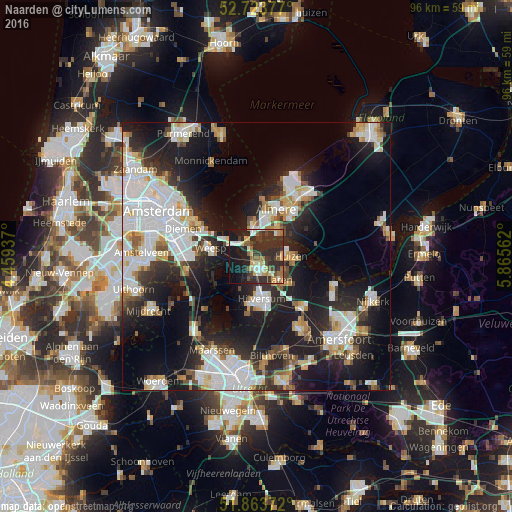
Analysis of Naarden night lights 2016
Square area 10x10 km:
 4.29%
4.29%90-99
6.94%80-89
4.04%70-79
5.68%60-69
6.19%50-59
4.04%40-49
5.3%30-39
11.62%20-29
26.89%10-19
20.58%0-9
4.42%Square area 50x50 km:
8.78%90-99
7.33%80-89
2.93%70-79
2.88%60-69
2.9%50-59
2.4%40-49
2.73%30-39
3.74%20-29
10.23%10-19
20.1%0-9
35.99%Clear (daylight) street map image can be seen on geolist.org.
Map coordinates:
52° 43' 25.6" North, 4° 27' 33.7" East
52° 17' 45" North, 5° 9' 45" East
51° 51' 49.4" North, 5° 51' 56.2" East
Some cities around Naarden sort by population:
• Hilversum
8.1 km =5 mi,  173°
173°
• Huizen
5.4 km =3.4 mi,  86°
86°
• Bussum
2.5 km =1.6 mi,  182°
182°
• Weesp
8.3 km =5.2 mi,  278°
278°
• Laren
6.2 km =3.9 mi,  134°
134°
• Kortenhoef
7.3 km =4.5 mi,  210°
210°
• Muiden
7.4 km =4.6 mi,  300°
300°
• Blaricum
6 km =3.7 mi,  115°
115°
2750521 (p: 17,115)
Sources (retrieved 2019-11-25):
» Earth at Night: Flat Maps 2012, 2016