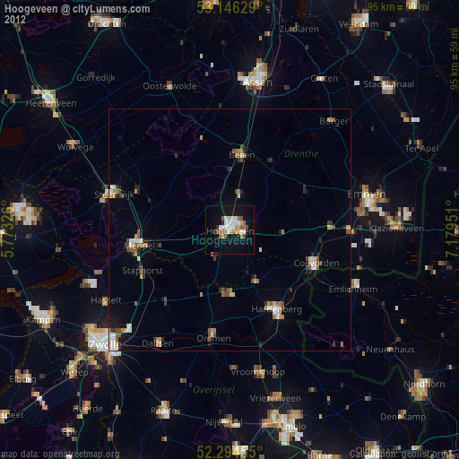
Hoogeveen night lights from space
Night Light of Hoogeveen (Drenthe) from space (Netherlands) Src. Average luminocity for 10x10km area is 15.2891% and for 50x50km: 3.448%.
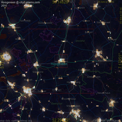
Analysis of Hoogeveen night lights 2016
Square area 10x10 km:
 1.89%
1.89%90-99
2.15%80-89
1.01%70-79
3.28%60-69
2.02%50-59
2.65%40-49
1.52%30-39
0.38%20-29
0%10-19
12.25%0-9
72.85%Square area 50x50 km:
0.38%90-99
0.58%80-89
0.36%70-79
0.46%60-69
0.36%50-59
0.47%40-49
0.5%30-39
0.3%20-29
0.36%10-19
1.58%0-9
94.64%Clear (daylight) street map image can be seen on geolist.org.
Map coordinates:
53° 8' 46.6" North, 5° 46' 23.7" East
52° 43' 21" North, 6° 28' 35" East
52° 17' 40.4" North, 7° 10' 46.2" East
Some cities around Hoogeveen sort by population:
• Hardenberg
18.9 km =11.7 mi,  149°
149°
• Meppel
19.2 km =11.9 mi,  261°
261°
• Steenwijk
25 km =15.5 mi,  286°
286°
• Staphorst
19.8 km =12.3 mi,  244°
244°
• Coevorden
19.1 km =11.9 mi,  111°
111°
• Ommen
22.7 km =14.1 mi,  189°
189°
• Beilen
15.9 km =9.9 mi,  9°
9°
• Krakeel
2.4 km =1.5 mi,  87°
87°
2753719 (p: 38,754)
Sources (retrieved 2019-11-25):
» Earth at Night: Flat Maps 2012, 2016