Alkmaar night lights from space
Night Light of Alkmaar (North Holland) from space (Netherlands) Src. Average luminocity for 10x10km area is 50.5423% and for 50x50km: 16.7238%.
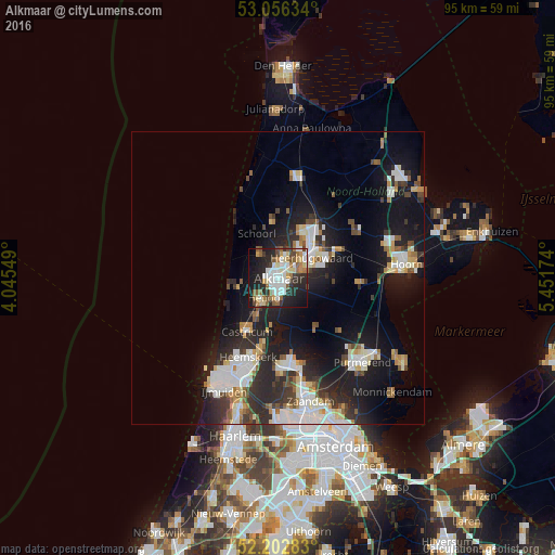
Analysis of Alkmaar night lights 2016
Square area 10x10 km:
 10.85%
90-99
12.17%80-89
5.56%70-79
4.23%60-69
7.67%50-59
7.54%40-49
3.57%30-39
4.5%20-29
19.84%10-19
19.18%0-9
4.89%Square area 50x50 km:
3.37%90-99
3.54%80-89
1.44%70-79
1.42%60-69
1.48%50-59
1.68%40-49
1.64%30-39
2.44%20-29
6.12%10-19
12.88%0-9
63.99%Clear (daylight) street map image can be seen on geolist.org.
Map coordinates:
53° 3' 22.8" North, 4° 2' 43.8" East
52° 37' 54" North, 4° 44' 55" East
52° 12' 10.2" North, 5° 27' 6.3" East
Some cities around Alkmaar sort by population:
• Heerhugowaard
8.1 km =5 mi,  56°
56°
• Castricum
10.7 km =6.6 mi,  209°
209°
• Heiloo
5.2 km =3.2 mi,  231°
231°
• Limmen
7.9 km =4.9 mi, 207°
• Zuid-Scharwoude
7.3 km =4.5 mi,  33°
33°
• Sint Pancras
3.9 km =2.4 mi,  36°
36°
• Broek op Langedijk
6.1 km =3.8 mi, 39°
• Noord-Scharwoude
8.5 km =5.3 mi, 29°
2759899 (p: 94,853)
Sources (retrieved 2019-11-25):
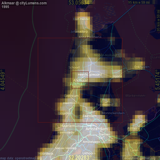
» NASA, Earths city lights 1995
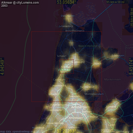
» NASA city lights 2003
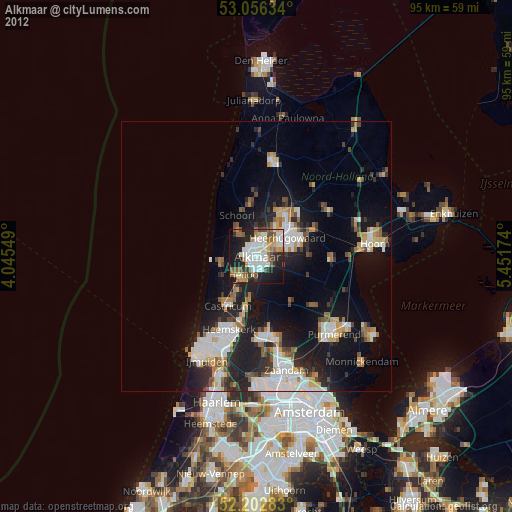
» Earth at Night: Flat Maps 2012, 2016