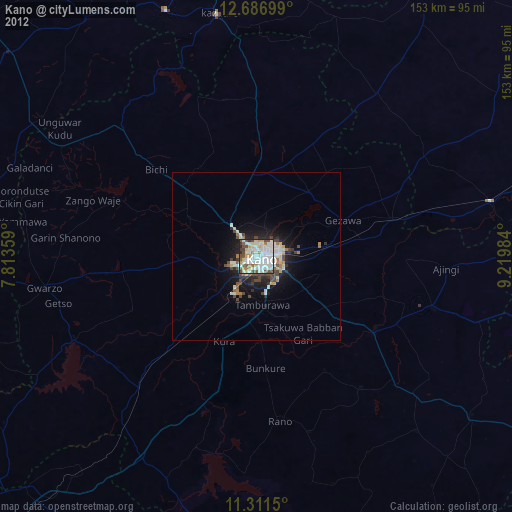
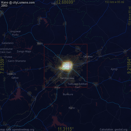
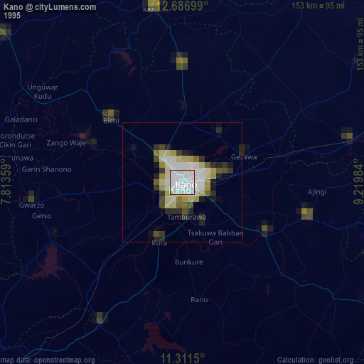
Kano night lights from space
Night Light of Kano from space (Nigeria) Src. Average luminocity for 10x10km area is 95.4194% and for 50x50km: 12.7645%.
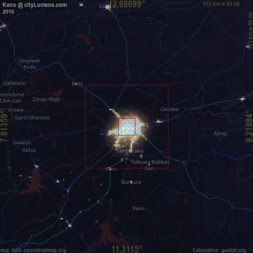
Analysis of Kano night lights 2016
Square area 10x10 km:
 57.44%
90-99
30.58%80-89
2.69%70-79
4.34%60-69
1.65%50-59
2.48%40-49
0.83%30-39
0%20-29
0%10-19
0%0-9
0%Square area 50x50 km:
3.29%90-99
3.12%80-89
0.91%70-79
0.94%60-69
1.02%50-59
1.37%40-49
2.34%30-39
1.83%20-29
2.8%10-19
5.39%0-9
76.99%Clear (daylight) street map image can be seen on geolist.org.
Map coordinates:
12° 41' 13.2" North, 7° 48' 48.9" East
12° 0' 0.4" North, 8° 31' 0.2" East
11° 18' 41.4" North, 9° 13' 11.4" East
Some cities around Kano sort by population:
• Wudil
41.5 km =25.8 mi,  120°
120°
• Gaya
55.1 km =34.2 mi,  106°
106°
• Rano
49.8 km =30.9 mi,  171°
171°
• Gwarzo
64.1 km =39.8 mi,  261°
261°
• Bebeji
46.2 km =28.7 mi,  216°
216°
• Kura
27.2 km =16.9 mi,  201°
201°
• Dambatta
48.4 km =30.1 mi,  359°
359°
• Kibiya
54.8 km =34.1 mi,  163°
163°
2335204 (p: 3,626,068)
Sources (retrieved 2019-11-25):
» NASA, Earths city lights 1995
» NASA city lights 2003
» Earth at Night: Flat Maps 2012, 2016