Ado-Ekiti night lights from space
Night Light of Ado-Ekiti (Ekiti) from space (Nigeria) Src. Average luminocity for 10x10km area is 5.1732% and for 50x50km: 0.25%.
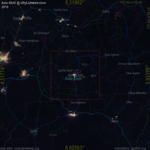
Analysis of Ado-Ekiti night lights 2016
Square area 10x10 km:
 0%
0%90-99
0%80-89
1.73%70-79
0%60-69
0%50-59
0.87%40-49
2.16%30-39
2.38%20-29
2.81%10-19
0.43%0-9
89.61%Square area 50x50 km:
0%90-99
0%80-89
0.07%70-79
0%60-69
0%50-59
0.03%40-49
0.13%30-39
0.13%20-29
0.11%10-19
0.03%0-9
99.5%Clear (daylight) street map image can be seen on geolist.org.
Map coordinates:
8° 19' 10.6" North, 4° 31' 3.9" East
7° 37' 23.8" North, 5° 13' 15.1" East
6° 55' 33" North, 5° 55' 26.4" East
Some cities around Ado-Ekiti sort by population:
• Ise-Ekiti
28.4 km =17.6 mi,  128°
128°
• Ijero-Ekiti
27.2 km =16.9 mi,  321°
321°
• Ikere-Ekiti
14 km =8.7 mi,  175°
175°
• Igede-Ekiti
11.6 km =7.2 mi,  295°
295°
• Ipoti
32.1 km =19.9 mi,  330°
330°
• Aramoko-Ekiti
21.8 km =13.5 mi,  294°
294°
• Igbara-Odo
22 km =13.7 mi,  232°
232°
• Ifaki
18.7 km =11.6 mi,  9°
9°
2352379 (p: 424,340)
Sources (retrieved 2019-11-25):
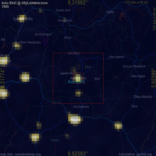
» NASA, Earths city lights 1995
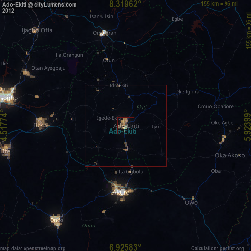
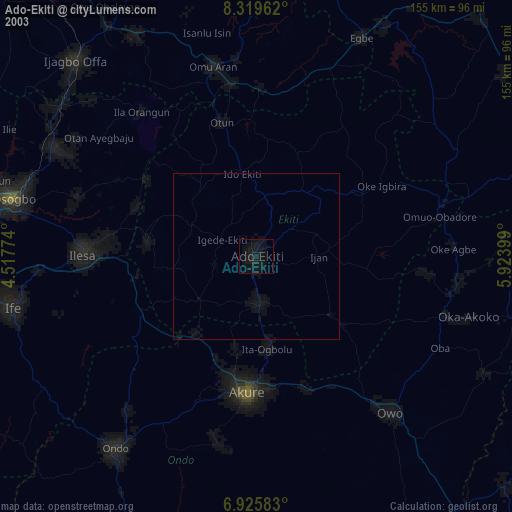
» NASA city lights 2003
» Earth at Night: Flat Maps 2012, 2016