Telaga Batu night lights from space
Night Light of Telaga Batu (Penang) from space (Malaysia) Src. Average luminocity for 10x10km area is 20.4504% and for 50x50km: 23.8408%.
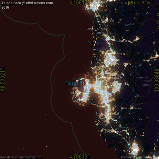
Analysis of Telaga Batu night lights 2016
Square area 10x10 km:
 2.69%
2.69%90-99
3.1%80-89
1.65%70-79
1.65%60-69
0.62%50-59
1.86%40-49
2.27%30-39
5.79%20-29
8.88%10-19
26.03%0-9
45.45%Square area 50x50 km:
5.83%90-99
4.96%80-89
1.95%70-79
2.48%60-69
2.45%50-59
2.99%40-49
4.82%30-39
4.44%20-29
5.56%10-19
7.17%0-9
57.36%Clear (daylight) street map image can be seen on geolist.org.
Map coordinates:
6° 9' 58.2" North, 99° 31' 48.8" East
5° 28' 0" North, 100° 13' 60" East
4° 45' 58.9" North, 100° 56' 11.3" East
Some cities around Telaga Batu sort by population:
• George Town
12.9 km =8 mi,  118°
118°
• Kampung Sungai Ara
16.2 km =10.1 mi,  164°
164°
• Butterworth
16.3 km =10.1 mi, 117°
• Perai
19 km =11.8 mi, 119°
• Permatang Kuching
16.4 km =10.2 mi,  91°
91°
• Tanjung Tokong
8.2 km =5.1 mi, 94°
• Batu Feringgi
1.4 km =0.9 mi,  70°
70°
• Kepala Batas
22.1 km =13.7 mi,  75°
75°
1740836 (p: 10,000)
Sources (retrieved 2019-11-25):
» Earth at Night: Flat Maps 2012, 2016