Batu Feringgi night lights from space
Night Light of Batu Feringgi (Penang) from space (Malaysia) Src. Average luminocity for 10x10km area is 26.5558% and for 50x50km: 25.8725%.
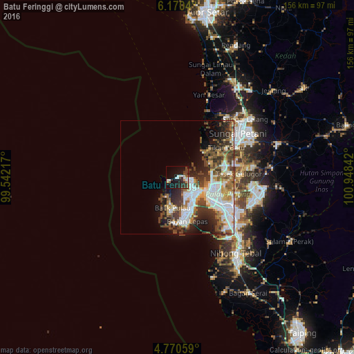
Analysis of Batu Feringgi night lights 2016
Square area 10x10 km:
 3.51%
3.51%90-99
4.34%80-89
2.89%70-79
2.69%60-69
1.03%50-59
1.65%40-49
5.17%30-39
9.3%20-29
8.68%10-19
24.79%0-9
35.95%Square area 50x50 km:
6.48%90-99
5.55%80-89
2.13%70-79
2.68%60-69
2.8%50-59
3.23%40-49
5.01%30-39
4.67%20-29
5.55%10-19
7.11%0-9
54.78%Clear (daylight) street map image can be seen on geolist.org.
Map coordinates:
6° 10' 13.4" North, 99° 32' 31.8" East
5° 28' 15.2" North, 100° 14' 43" East
4° 46' 14.1" North, 100° 56' 54.3" East
Some cities around Batu Feringgi sort by population:
• George Town
12 km =7.5 mi,  123°
123°
• Kampung Sungai Ara
16.3 km =10.1 mi,  168°
168°
• Butterworth
15.4 km =9.6 mi, 121°
• Perai
18.1 km =11.2 mi, 122°
• Permatang Kuching
15.1 km =9.4 mi,  93°
93°
• Tanjung Tokong
7 km =4.3 mi,  99°
99°
• Kepala Batas
20.7 km =12.9 mi,  75°
75°
• Telaga Batu
1.4 km =0.9 mi,  250°
250°
1735074 (p: 20,000)
Sources (retrieved 2019-11-25):
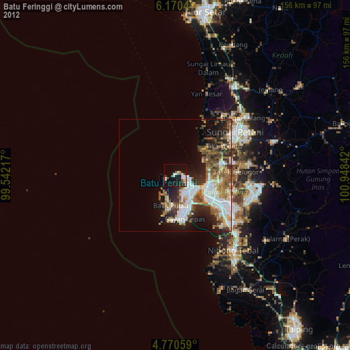
» Earth at Night: Flat Maps 2012, 2016