Kampong Dungun night lights from space
Night Light of Kampong Dungun (Perak) from space (Malaysia) Src. Average luminocity for 10x10km area is 23.6429% and for 50x50km: 33.1031%.
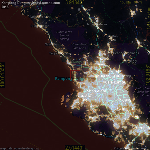
Analysis of Kampong Dungun night lights 2016
Square area 10x10 km:
 0.22%
0.22%90-99
0.22%80-89
0.65%70-79
2.6%60-69
5.19%50-59
6.28%40-49
9.96%30-39
1.73%20-29
4.76%10-19
48.05%0-9
20.35%Square area 50x50 km:
10.03%90-99
7.06%80-89
2.35%70-79
2.97%60-69
5.2%50-59
4.36%40-49
3.71%30-39
2.63%20-29
5.29%10-19
12.24%0-9
44.17%Clear (daylight) street map image can be seen on geolist.org.
Map coordinates:
3° 55' 6.3" North, 100° 36' 48.8" East
3° 13' 0" North, 101° 19' 0" East
2° 30' 51.9" North, 102° 1' 11.3" East
Some cities around Kampong Dungun sort by population:
• Klang
24.5 km =15.2 mi,  144°
144°
• Kampung Baru Subang
25.2 km =15.7 mi,  107°
107°
• Kuala Selangor
16.6 km =10.3 mi,  333°
333°
• Ladang Seri Kundang
23.7 km =14.7 mi,  71°
71°
• Batu Arang
20 km =12.4 mi,  56°
56°
• Kuang
26.8 km =16.7 mi,  79°
79°
• Batang Berjuntai
21.6 km =13.4 mi,  30°
30°
• Pelabuhan Klang
25.6 km =15.9 mi,  160°
160°
1769612 (p: 58,674)
Sources (retrieved 2019-11-25):
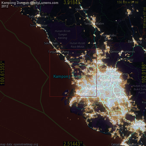
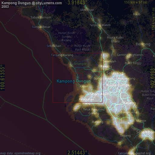
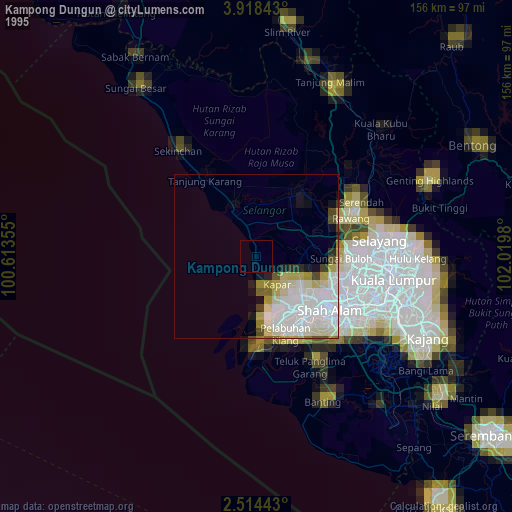
» NASA, Earths city lights 1995
» NASA city lights 2003
» Earth at Night: Flat Maps 2012, 2016