Sungai Udang night lights from space
Night Light of Sungai Udang (Melaka) from space (Malaysia) Src. Average luminocity for 10x10km area is 67.2771% and for 50x50km: 27.5661%.
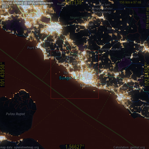
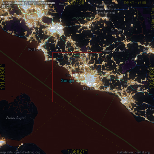
Analysis of Sungai Udang night lights 2016
Square area 10x10 km:
 13.42%
90-99
18.83%80-89
8.44%70-79
9.31%60-69
11.47%50-59
10.82%40-49
3.68%30-39
11.9%20-29
9.52%10-19
2.6%0-9
0%Square area 50x50 km:
5.38%90-99
4.61%80-89
2.59%70-79
3.05%60-69
4.27%50-59
4.98%40-49
4.82%30-39
4.25%20-29
7.28%10-19
11.9%0-9
46.87%Clear (daylight) street map image can be seen on geolist.org.
Map coordinates:
2° 58' 17" North, 101° 26' 22.5" East
2° 16' 8.4" North, 102° 8' 33.7" East
1° 33' 58.6" North, 102° 50' 45" East
Some cities around Sungai Udang sort by population:
• Malacca
13.6 km =8.5 mi,  126°
126°
• Klebang Besar
8.4 km =5.2 mi, 131°
• Kampung Ayer Keroh
15.3 km =9.5 mi,  91°
91°
• Kampong Masjid Tanah
9.5 km =5.9 mi,  342°
342°
• Batu Berendam
11.7 km =7.3 mi,  101°
101°
• Alor Gajah
14.4 km =8.9 mi,  30°
30°
• Bukit Rambai
4.7 km =2.9 mi, 103°
• Kuala Sungai Baru
15.6 km =9.7 mi,  310°
310°
1734757 (p: 26,044)
Sources (retrieved 2019-11-25):
» Earth at Night: Flat Maps 2012, 2016