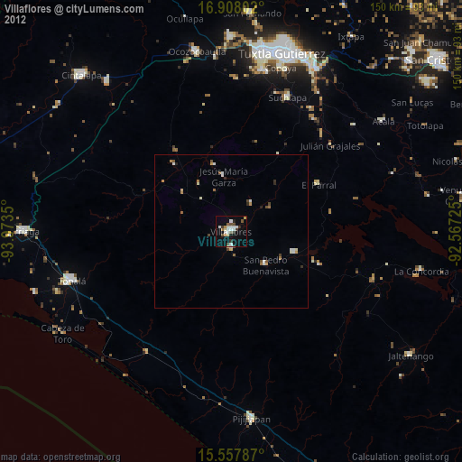
Villaflores night lights from space
Night Light of Villaflores (Chiapas) from space (Mexico) Src. Average luminocity for 10x10km area is 27.3512% and for 50x50km: 2.5849%.
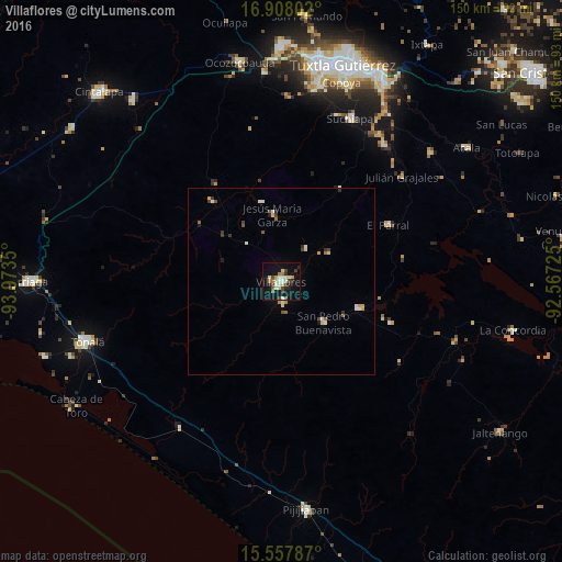
Analysis of Villaflores night lights 2016
Square area 10x10 km:
 2.69%
2.69%90-99
5.58%80-89
5.37%70-79
1.45%60-69
3.1%50-59
1.86%40-49
5.17%30-39
3.51%20-29
4.75%10-19
28.31%0-9
38.22%Square area 50x50 km:
0.12%90-99
0.6%80-89
0.44%70-79
0.23%60-69
0.26%50-59
0.23%40-49
0.45%30-39
0.4%20-29
0.33%10-19
1.31%0-9
95.63%Clear (daylight) street map image can be seen on geolist.org.
Map coordinates:
16° 54' 28.9" North, 93° 58' 24.6" West
16° 14' 2.8" North, 93° 16' 13.3" West
15° 33' 28.3" North, 92° 34' 2.1" West
Some cities around Villaflores sort by population:
• Chiapa de Corzo
59.4 km =36.9 mi,  27°
27°
• Tonalá
54.2 km =33.7 mi,  252°
252°
• Suchiapa
47.1 km =29.3 mi,  22°
22°
• El Parral
32.1 km =19.9 mi,  61°
61°
• San Pedro Buenavista
23.5 km =14.6 mi,  135°
135°
• Copoya
55.5 km =34.5 mi, 16°
• Revolución Mexicana
21.8 km =13.5 mi,  108°
108°
• Jesús María Garza
18.2 km =11.3 mi,  352°
352°
3514677 (p: 37,237)
Sources (retrieved 2019-11-25):
» Earth at Night: Flat Maps 2012, 2016