Técpan de Galeana night lights from space
Night Light of Técpan de Galeana (Guerrero) from space (Mexico) Src. Average luminocity for 10x10km area is 13.8388% and for 50x50km: 1.6118%.
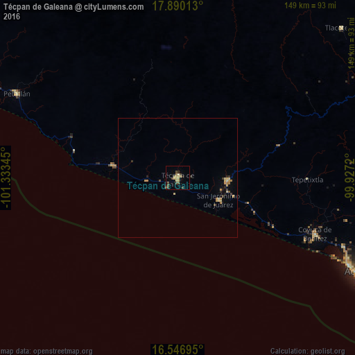
Analysis of Técpan de Galeana night lights 2016
Square area 10x10 km:
 0%
0%90-99
0.21%80-89
2.27%70-79
5.17%60-69
1.86%50-59
0%40-49
7.44%30-39
0.62%20-29
1.03%10-19
0.41%0-9
80.99%Square area 50x50 km:
0%90-99
0.02%80-89
0.38%70-79
0.54%60-69
0.22%50-59
0.03%40-49
0.38%30-39
0.2%20-29
0.22%10-19
0.16%0-9
97.83%Clear (daylight) street map image can be seen on geolist.org.
Map coordinates:
17° 53' 24.5" North, 101° 20' 0.4" West
17° 13' 11.1" North, 100° 37' 49.2" West
16° 32' 49" North, 99° 55' 37.9" West
Some cities around Técpan de Galeana sort by population:
• Petatlán
76.3 km =47.4 mi,  297°
297°
• Atoyac de Álvarez
21 km =13 mi,  93°
93°
• Coyuca de Benítez
62.3 km =38.7 mi,  112°
112°
• San Jerónimo de Juárez
19.2 km =11.9 mi,  117°
117°
• El Súchil
1.2 km =0.7 mi,  310°
310°
• San Jeronimito
85.2 km =52.9 mi, 297°
• Bajos del Ejido
75.7 km =47 mi, 112°
• San Luis de La Loma
28.5 km =17.7 mi,  281°
281°
3982170 (p: 15,119)
Sources (retrieved 2019-11-25):
» Earth at Night: Flat Maps 2012, 2016