Santiago de Querétaro night lights from space
Night Light of Santiago de Querétaro (Querétaro) from space (Mexico) Src. Average luminocity for 10x10km area is 95.7008% and for 50x50km: 38.5085%.
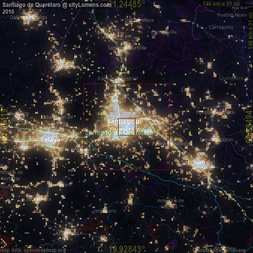
Analysis of Santiago de Querétaro night lights 2016
Square area 10x10 km:
 56.82%
90-99
25.19%80-89
11.93%70-79
3.79%60-69
2.27%50-59
0%40-49
0%30-39
0%20-29
0%10-19
0%0-9
0%Square area 50x50 km:
5.56%90-99
4.93%80-89
6.33%70-79
6.92%60-69
5.95%50-59
4.71%40-49
7.38%30-39
6.45%20-29
9.79%10-19
15.45%0-9
26.52%Clear (daylight) street map image can be seen on geolist.org.
Map coordinates:
21° 14' 41.5" North, 101° 5' 28.3" West
20° 35' 17" North, 100° 23' 17" West
19° 55' 42.3" North, 99° 41' 5.8" West
Some cities around Santiago de Querétaro sort by population:
• El Pueblito
7.5 km =4.7 mi,  224°
224°
• San Jose de los Olvera
4.8 km =3 mi, 215°
• Venceremos
4.3 km =2.7 mi,  194°
194°
• San José el Alto
7.3 km =4.5 mi,  4°
4°
• San Pedro Mártir
9.2 km =5.7 mi,  291°
291°
• La Cañada
6.2 km =3.9 mi,  68°
68°
• Santa María Magdalena
6.3 km =3.9 mi,  279°
279°
• La Pradera
9.2 km =5.7 mi,  31°
31°
3991164 (p: 626,495)
Sources (retrieved 2019-11-25):
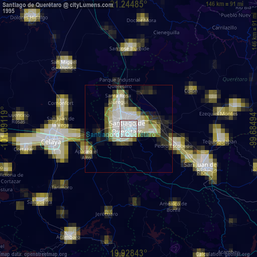
» NASA, Earths city lights 1995
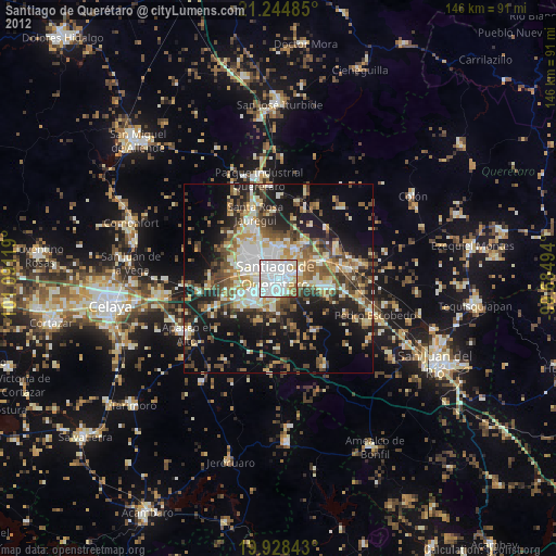
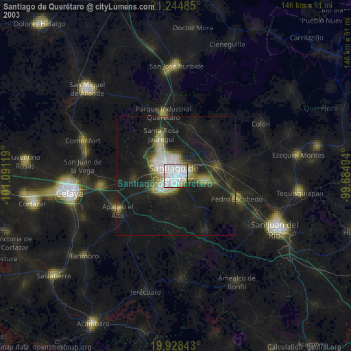
» NASA city lights 2003
» Earth at Night: Flat Maps 2012, 2016