San Pedro Mártir night lights from space
Night Light of San Pedro Mártir (Querétaro) from space (Mexico) Src. Average luminocity for 10x10km area is 85.8902% and for 50x50km: 37.3612%.
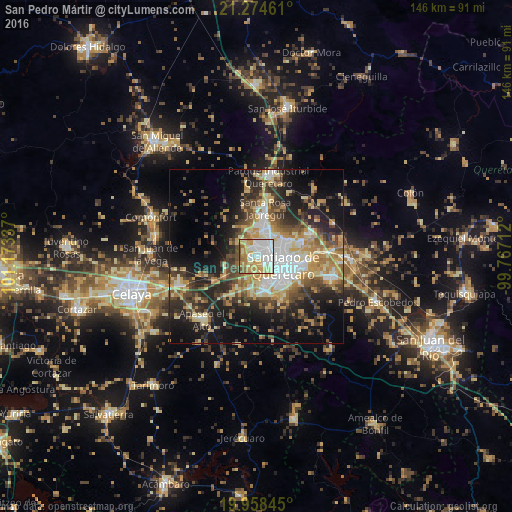
Analysis of San Pedro Mártir night lights 2016
Square area 10x10 km:
 29.73%
90-99
20.45%80-89
18.37%70-79
14.39%60-69
9.28%50-59
6.44%40-49
1.33%30-39
0%20-29
0%10-19
0%0-9
0%Square area 50x50 km:
5.71%90-99
5%80-89
6.35%70-79
6.45%60-69
5.5%50-59
4.27%40-49
6.55%30-39
6.36%20-29
9.12%10-19
16.64%0-9
28.03%Clear (daylight) street map image can be seen on geolist.org.
Map coordinates:
21° 16' 28.6" North, 101° 10' 24.1" West
20° 37' 4.6" North, 100° 28' 12.9" West
19° 57' 30.4" North, 99° 46' 1.6" West
Some cities around San Pedro Mártir sort by population:
• Santiago de Querétaro
9.2 km =5.7 mi,  111°
111°
• El Pueblito
9.3 km =5.8 mi,  158°
158°
• San Jose de los Olvera
9.2 km =5.7 mi,  141°
141°
• Venceremos
10.6 km =6.6 mi,  134°
134°
• San José el Alto
10 km =6.2 mi,  66°
66°
• Juriquilla
10.7 km =6.6 mi,  8°
8°
• Santa María Magdalena
3.3 km =2.1 mi, 134°
• La Negreta
10.4 km =6.5 mi,  168°
168°
4029453 (p: 11,552)
Sources (retrieved 2019-11-25):
» Earth at Night: Flat Maps 2012, 2016