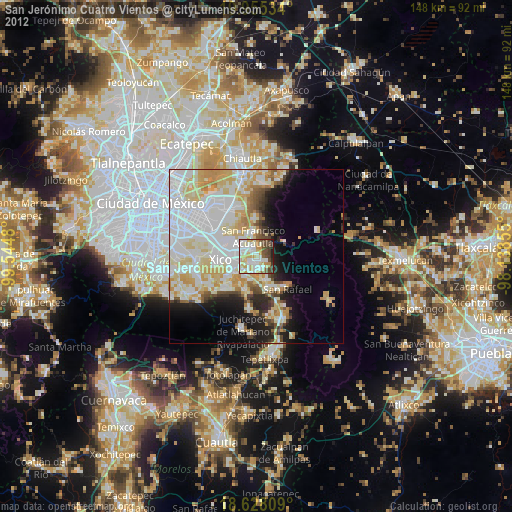
San Jerónimo Cuatro Vientos night lights from space
Night Light of San Jerónimo Cuatro Vientos (México) from space (Mexico) Src. Average luminocity for 10x10km area is 80.7554% and for 50x50km: 44.7246%.
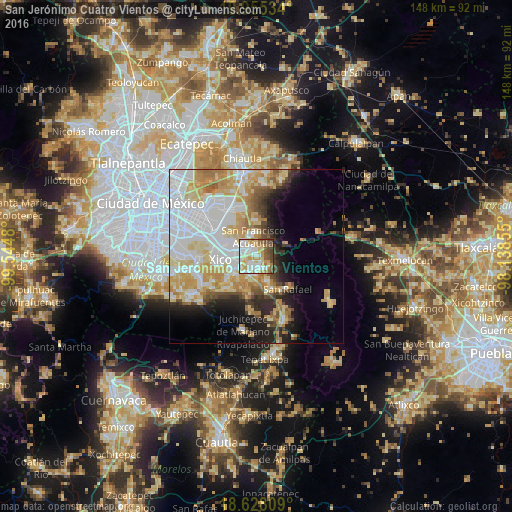
Analysis of San Jerónimo Cuatro Vientos night lights 2016
Square area 10x10 km:
 20.56%
90-99
22.51%80-89
16.02%70-79
13.85%60-69
6.93%50-59
9.09%40-49
9.52%30-39
1.52%20-29
0%10-19
0%0-9
0%Square area 50x50 km:
14.02%90-99
8.43%80-89
8.14%70-79
7.48%60-69
5.05%50-59
2.7%40-49
3.26%30-39
2.38%20-29
4.96%10-19
7.71%0-9
35.88%Clear (daylight) street map image can be seen on geolist.org.
Map coordinates:
19° 57' 19.2" North, 99° 32' 41.3" West
19° 17' 35" North, 98° 50' 30" West
18° 37' 41.1" North, 98° 8' 18.8" West
Some cities around San Jerónimo Cuatro Vientos sort by population:
• Ixtapaluca
5 km =3.1 mi,  300°
300°
• San Buenaventura
2.5 km =1.6 mi, 295°
• San Martín Cuautlalpan
2.2 km =1.4 mi,  150°
150°
• San Gregorio Cuautzingo
4.1 km =2.5 mi,  203°
203°
• Santa María Huexoculco
4.5 km =2.8 mi, 150°
• San Marcos Huixtoco
2.3 km =1.4 mi,  279°
279°
• Jorge Jiménez Cantú
1.9 km =1.2 mi,  344°
344°
• La Candelaria Tlapala
5.9 km =3.7 mi,  186°
186°
8858091 (p: 36,778)
Sources (retrieved 2019-11-25):
» Earth at Night: Flat Maps 2012, 2016