Ramos Arizpe night lights from space
Night Light of Ramos Arizpe (Coahuila) from space (Mexico) Src. Average luminocity for 10x10km area is 67.1151% and for 50x50km: 14.8094%.
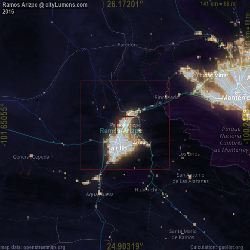
Analysis of Ramos Arizpe night lights 2016
Square area 10x10 km:
 13.1%
13.1%90-99
15.48%80-89
10.91%70-79
9.52%60-69
11.11%50-59
10.32%40-49
9.72%30-39
9.72%20-29
7.34%10-19
2.78%0-9
0%Square area 50x50 km:
3.89%90-99
2.85%80-89
1.54%70-79
1.51%60-69
1.76%50-59
1.58%40-49
1.6%30-39
2.06%20-29
3.71%10-19
6.18%0-9
73.32%Clear (daylight) street map image can be seen on geolist.org.
Map coordinates:
26° 10' 19.2" North, 101° 39' 2" West
25° 32' 21.4" North, 100° 56' 50.7" West
24° 54' 11.5" North, 100° 14' 39.5" West
Some cities around Ramos Arizpe sort by population:
• Saltillo
14.2 km =8.8 mi,  204°
204°
• Santa Catarina
51.3 km =31.9 mi,  73°
73°
• San Pedro Garza García
55.9 km =34.7 mi,  76°
76°
• García
46.3 km =28.8 mi,  49°
49°
• Parque Industrial Ciudad Mitras
57.2 km =35.5 mi,  61°
61°
• Mitras Poniente
58.5 km =36.4 mi, 63°
• Arteaga
14.5 km =9 mi,  135°
135°
• Valle de Lincoln
54.9 km =34.1 mi, 59°
3991043 (p: 66,554)
Sources (retrieved 2019-11-25):
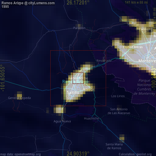
» NASA, Earths city lights 1995
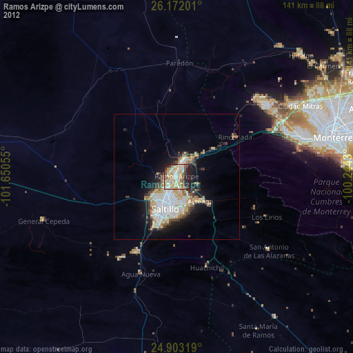
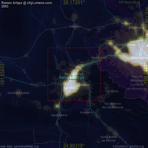
» NASA city lights 2003
» Earth at Night: Flat Maps 2012, 2016