García night lights from space
Night Light of García (Nuevo León) from space (Mexico) Src. Average luminocity for 10x10km area is 48.6193% and for 50x50km: 19.6653%.
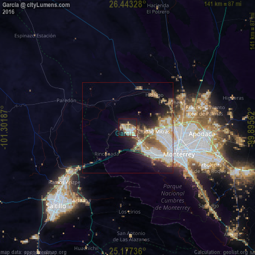
Analysis of García night lights 2016
Square area 10x10 km:
 10.23%
90-99
7.95%80-89
8.33%70-79
8.14%60-69
5.11%50-59
7.77%40-49
3.98%30-39
3.79%20-29
10.23%10-19
29.17%0-9
5.3%Square area 50x50 km:
4.65%90-99
3.54%80-89
2.31%70-79
2.37%60-69
3.18%50-59
2.88%40-49
2.48%30-39
2.01%20-29
3.56%10-19
6.44%0-9
66.58%Clear (daylight) street map image can be seen on geolist.org.
Map coordinates:
26° 26' 35.8" North, 101° 18' 6.7" West
25° 48' 43.2" North, 100° 35' 55.5" West
25° 10' 38.5" North, 99° 53' 44.2" West
Some cities around García sort by population:
• Ciudad General Escobedo
28.2 km =17.5 mi,  93°
93°
• Santa Catarina
20.9 km =13 mi,  137°
137°
• San Pedro Garza García
25.6 km =15.9 mi,  131°
131°
• Parque Industrial Ciudad Mitras
15.3 km =9.5 mi,  99°
99°
• Mitras Poniente
17.8 km =11.1 mi, 103°
• Hidalgo
23.2 km =14.4 mi,  39°
39°
• Carmen
27.3 km =17 mi,  59°
59°
• Valle de Lincoln
12.3 km =7.6 mi, 99°
3980190 (p: 93,641)
Sources (retrieved 2019-11-25):
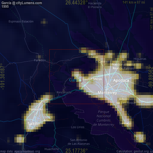
» NASA, Earths city lights 1995
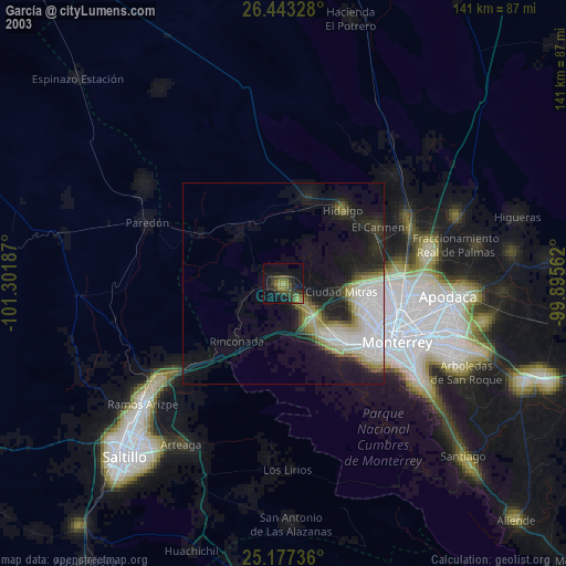
» NASA city lights 2003
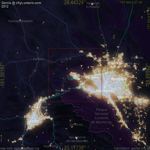
» Earth at Night: Flat Maps 2012, 2016