Miraflores night lights from space
Night Light of Miraflores (México) from space (Mexico) Src. Average luminocity for 10x10km area is 58.7316% and for 50x50km: 35.6099%.
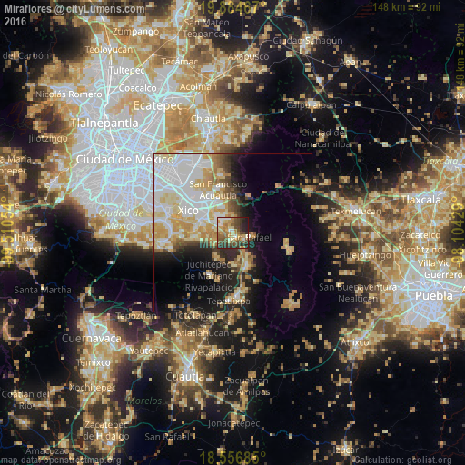
Analysis of Miraflores night lights 2016
Square area 10x10 km:
 5.63%
5.63%90-99
7.58%80-89
9.31%70-79
11.47%60-69
14.5%50-59
11.26%40-49
15.58%30-39
9.52%20-29
12.55%10-19
2.6%0-9
0%Square area 50x50 km:
9.67%90-99
6.49%80-89
6.29%70-79
5.89%60-69
4.08%50-59
2.16%40-49
3.28%30-39
2.22%20-29
5.34%10-19
10.35%0-9
44.21%Clear (daylight) street map image can be seen on geolist.org.
Map coordinates:
19° 53' 4.8" North, 99° 30' 37.9" West
19° 13' 19.6" North, 98° 48' 26.7" West
18° 33' 24.7" North, 98° 6' 15.4" West
Some cities around Miraflores sort by population:
• San Martín Cuautlalpan
6.5 km =4 mi,  337°
337°
• San Rafael
5.5 km =3.4 mi,  104°
104°
• Tlalmanalco
2 km =1.2 mi,  160°
160°
• San Gregorio Cuautzingo
6.7 km =4.2 mi,  308°
308°
• Santa María Huexoculco
4.2 km =2.6 mi, 341°
• Cocotitlán
6.3 km =3.9 mi,  281°
281°
• Temamatla
6.8 km =4.2 mi,  251°
251°
• La Candelaria Tlapala
4.7 km =2.9 mi,  295°
295°
3761194 (p: 9,904)
Sources (retrieved 2019-11-25):
» Earth at Night: Flat Maps 2012, 2016