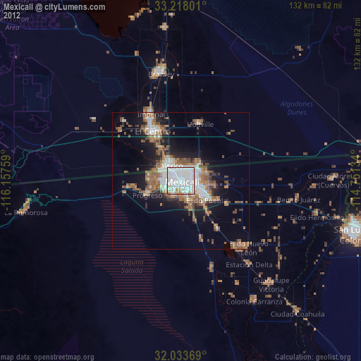
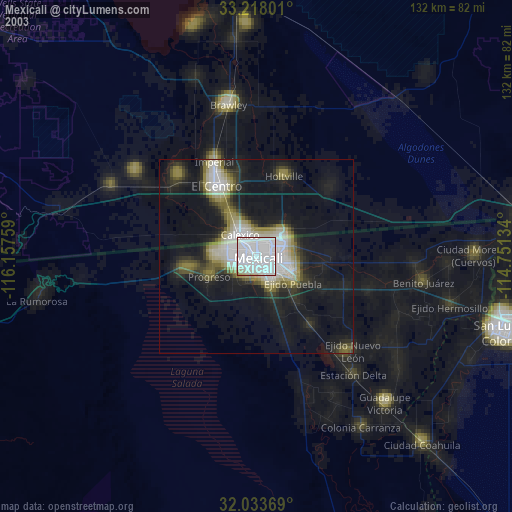
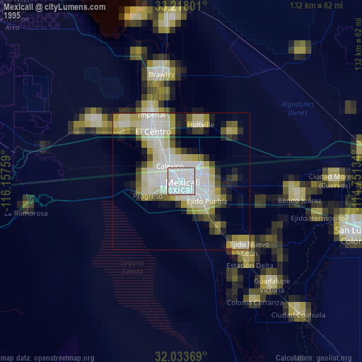
Mexicali night lights from space
Night Light of Mexicali (Baja California) from space (Mexico) Src. Average luminocity for 10x10km area is 97.3881% and for 50x50km: 19.7164%.
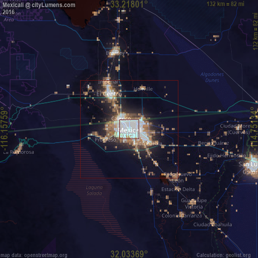
Analysis of Mexicali night lights 2016
Square area 10x10 km:
 75.35%
90-99
16.43%80-89
1.57%70-79
2.8%60-69
3.5%50-59
0.35%40-49
0%30-39
0%20-29
0%10-19
0%0-9
0%Square area 50x50 km:
5.11%90-99
2.59%80-89
0.6%70-79
0.93%60-69
4.81%50-59
3.98%40-49
2.71%30-39
2.55%20-29
4.81%10-19
9.04%0-9
62.86%Clear (daylight) street map image can be seen on geolist.org.
Map coordinates:
33° 13' 4.8" North, 116° 9' 27.3" West
32° 37' 40.1" North, 115° 27' 16.1" West
32° 2' 1.3" North, 114° 45' 4.8" West
Some cities around Mexicali sort by population:
• El Centro, US
20.9 km =13 mi,  330°
330°
• Calexico, US
7 km =4.3 mi,  323°
323°
• Santa Isabel
11.4 km =7.1 mi,  273°
273°
• Imperial, US
26.7 km =16.6 mi,  336°
336°
• Puebla
11.7 km =7.3 mi,  125°
125°
• Progreso
13.3 km =8.3 mi,  246°
246°
• Holtville, US
21.5 km =13.4 mi,  18°
18°
• Delta
38.8 km =24.1 mi,  141°
141°
3996069 (p: 689,775)
Sources (retrieved 2019-11-25):
» NASA, Earths city lights 1995
» NASA city lights 2003
» Earth at Night: Flat Maps 2012, 2016