Mazatlan night lights from space
Night Light of Mazatlan (Nuevo León) from space (Mexico) Src. Average luminocity for 10x10km area is 32.3294% and for 50x50km: 4.1704%.
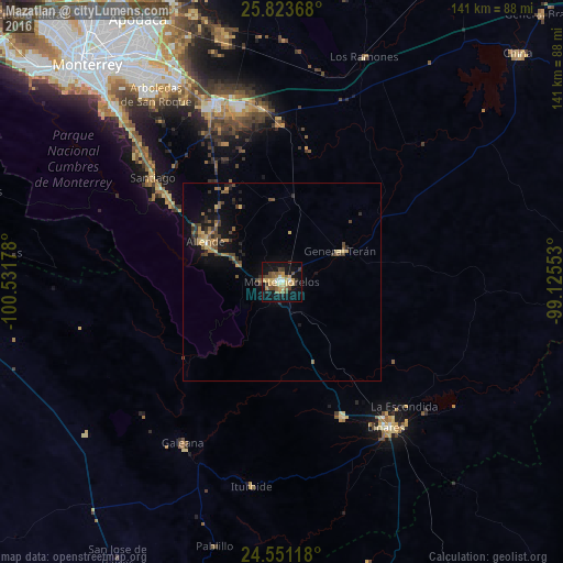
Analysis of Mazatlan night lights 2016
Square area 10x10 km:
 2.18%
2.18%90-99
1.98%80-89
6.94%70-79
7.54%60-69
3.77%50-59
5.95%40-49
7.34%30-39
3.57%20-29
2.38%10-19
33.33%0-9
25%Square area 50x50 km:
0.09%90-99
0.11%80-89
0.65%70-79
0.7%60-69
0.57%50-59
0.91%40-49
1.01%30-39
0.83%20-29
0.75%10-19
3.36%0-9
91.03%Clear (daylight) street map image can be seen on geolist.org.
Map coordinates:
25° 49' 25.2" North, 100° 31' 54.4" West
25° 11' 20.7" North, 99° 49' 43.1" West
24° 33' 4.2" North, 99° 7' 31.9" West
Some cities around Mazatlan sort by population:
• Cadereyta Jiménez
47.7 km =29.6 mi,  338°
338°
• Cadereyta
46.5 km =28.9 mi, 340°
• Linares
45.2 km =28.1 mi,  144°
144°
• Santiago
41.8 km =26 mi,  308°
308°
• Ciudad de Allende
21.1 km =13.1 mi,  297°
297°
• Galeana
47.6 km =29.6 mi,  211°
211°
• Ciudad General Terán
16.5 km =10.3 mi,  62°
62°
• Hualahuises
37.4 km =23.2 mi,  155°
155°
3523011 (p: 45,108)
Sources (retrieved 2019-11-25):
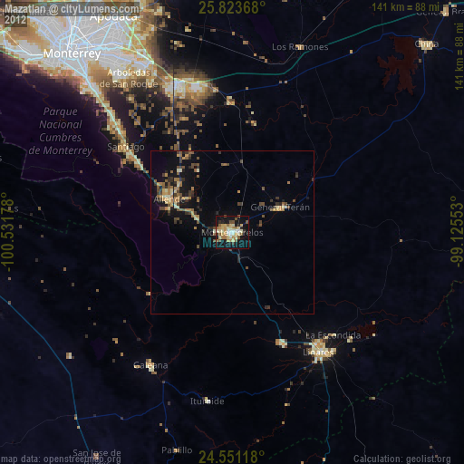
» Earth at Night: Flat Maps 2012, 2016