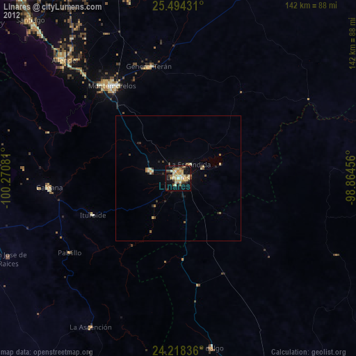
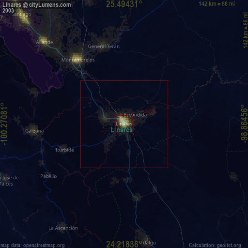
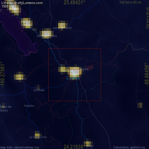
Linares night lights from space
Night Light of Linares (Nuevo León) from space (Mexico) Src. Average luminocity for 10x10km area is 32.0436% and for 50x50km: 1.9589%.

Analysis of Linares night lights 2016
Square area 10x10 km:
 1.52%
1.52%90-99
2.27%80-89
7.95%70-79
6.82%60-69
6.82%50-59
4.92%40-49
3.79%30-39
2.65%20-29
3.03%10-19
33.33%0-9
26.89%Square area 50x50 km:
0.06%90-99
0.12%80-89
0.46%70-79
0.36%60-69
0.37%50-59
0.29%40-49
0.17%30-39
0.19%20-29
0.27%10-19
1.56%0-9
96.16%Clear (daylight) street map image can be seen on geolist.org.
Map coordinates:
25° 29' 39.5" North, 100° 16' 14.9" West
24° 51' 28.7" North, 99° 34' 3.6" West
24° 13' 6.1" North, 98° 51' 52.4" West
Some cities around Linares sort by population:
• Cadereyta Jiménez
92.3 km =57.4 mi,  331°
331°
• Cadereyta
90.8 km =56.4 mi, 332°
• Mazatlan
45.2 km =28.1 mi,  324°
324°
• Santiago
86.3 km =53.6 mi, 317°
• Ciudad de Allende
64.7 km =40.2 mi, 315°
• Galeana
51.4 km =31.9 mi,  265°
265°
• Ciudad General Terán
46 km =28.6 mi,  345°
345°
• Hualahuises
11.2 km =7 mi,  284°
284°
3524348 (p: 63,104)
Sources (retrieved 2019-11-25):
» NASA, Earths city lights 1995
» NASA city lights 2003
» Earth at Night: Flat Maps 2012, 2016