Heroica Guaymas night lights from space
Night Light of Heroica Guaymas (Sonora) from space (Mexico) Src. Average luminocity for 10x10km area is 59.9167% and for 50x50km: 6.2218%.
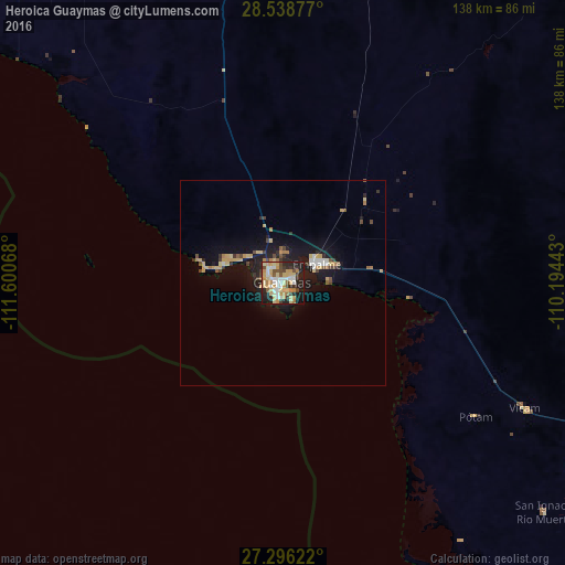
Analysis of Heroica Guaymas night lights 2016
Square area 10x10 km:
 9.28%
9.28%90-99
10.23%80-89
16.67%70-79
15.72%60-69
3.41%50-59
3.22%40-49
6.44%30-39
6.63%20-29
16.67%10-19
11.36%0-9
0.38%Square area 50x50 km:
0.59%90-99
0.63%80-89
1.29%70-79
1.23%60-69
0.55%50-59
0.41%40-49
0.89%30-39
0.68%20-29
1.51%10-19
5.85%0-9
86.36%Clear (daylight) street map image can be seen on geolist.org.
Map coordinates:
28° 32' 19.6" North, 111° 36' 2.4" West
27° 55' 9.4" North, 110° 53' 51.2" West
27° 17' 46.4" North, 110° 11' 39.9" West
Some cities around Heroica Guaymas sort by population:
• Empalme
9.5 km =5.9 mi,  60°
60°
• Esperanza
102.5 km =63.7 mi,  111°
111°
• Vicam
66.9 km =41.6 mi,  117°
117°
• Cocorit
100 km =62.1 mi, 112°
• San Ignacio Río Muerto
85.1 km =52.9 mi,  131°
131°
• Potam
57.5 km =35.7 mi, 124°
• Francisco Javier Mina
92.8 km =57.7 mi, 123°
• Campo Sesenta
94.3 km =58.6 mi, 123°
4005143 (p: 113,082)
Sources (retrieved 2019-11-25):
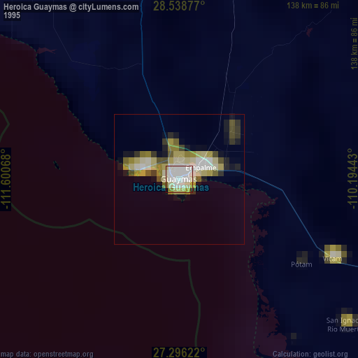
» NASA, Earths city lights 1995
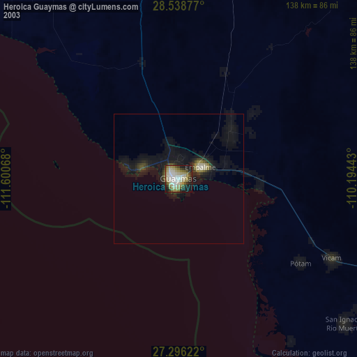
» NASA city lights 2003
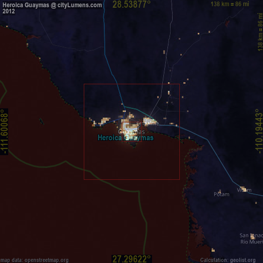
» Earth at Night: Flat Maps 2012, 2016