Hacienda Santa Fe night lights from space
Night Light of Hacienda Santa Fe (Jalisco) from space (Mexico) Src. Average luminocity for 10x10km area is 85.5739% and for 50x50km: 48.4828%.
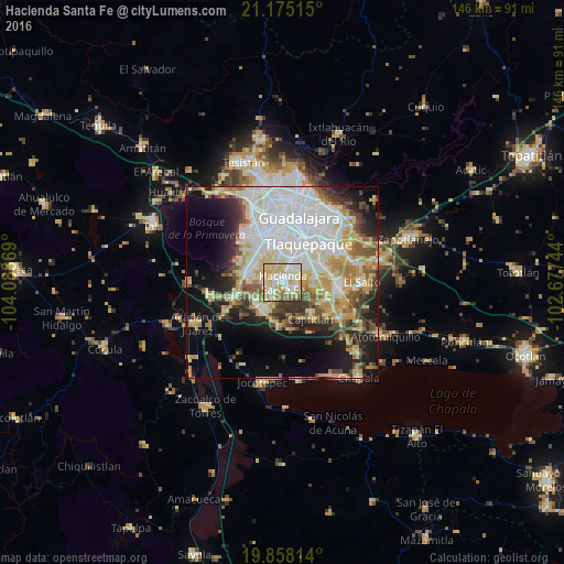
Analysis of Hacienda Santa Fe night lights 2016
Square area 10x10 km:
 21.97%
90-99
25.19%80-89
26.14%70-79
11.17%60-69
7.39%50-59
3.6%40-49
4.36%30-39
0.19%20-29
0%10-19
0%0-9
0%Square area 50x50 km:
14.73%90-99
9.2%80-89
8.53%70-79
6.53%60-69
4.26%50-59
4.09%40-49
4.61%30-39
4.65%20-29
6.15%10-19
11.83%0-9
25.43%Clear (daylight) street map image can be seen on geolist.org.
Map coordinates:
21° 10' 30.5" North, 104° 5' 1.3" West
20° 31' 5" North, 103° 22' 50" West
19° 51' 29.3" North, 102° 40' 38.8" West
Some cities around Hacienda Santa Fe sort by population:
• San Sebastián el Grande
5.2 km =3.2 mi,  288°
288°
• Santa Anita
7.5 km =4.7 mi,  298°
298°
• Lomas del Sur
4.8 km =3 mi,  233°
233°
• Santa Cruz del Valle
5.8 km =3.6 mi, 287°
• Real del Valle (El Paraíso) [Fraccionamiento]
3.3 km =2.1 mi,  20°
20°
• Villas de la Hacienda [Fraccionamiento]
1.5 km =0.9 mi,  350°
350°
• Valle Dorado Inn
2.1 km =1.3 mi,  69°
69°
• Colinas del Roble
2.4 km =1.5 mi, 230°
8858085 (p: 86,935)
Sources (retrieved 2019-11-25):
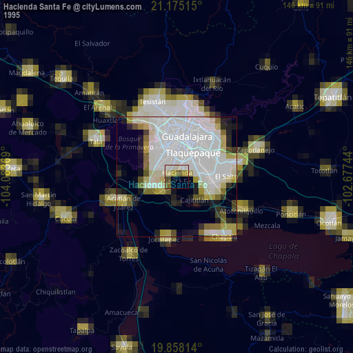
» NASA, Earths city lights 1995
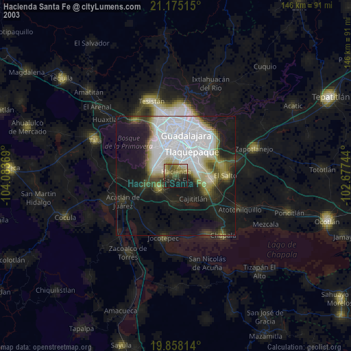
» NASA city lights 2003
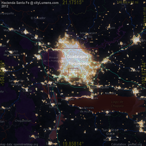
» Earth at Night: Flat Maps 2012, 2016